Isolated showers, storms possible Tuesday
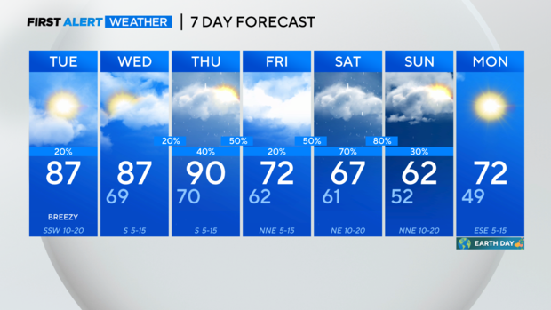
NORTH TEXAS - As we move through this Tuesday, a few isolated showers and storms are possible as a cold front tracks through North Texas.
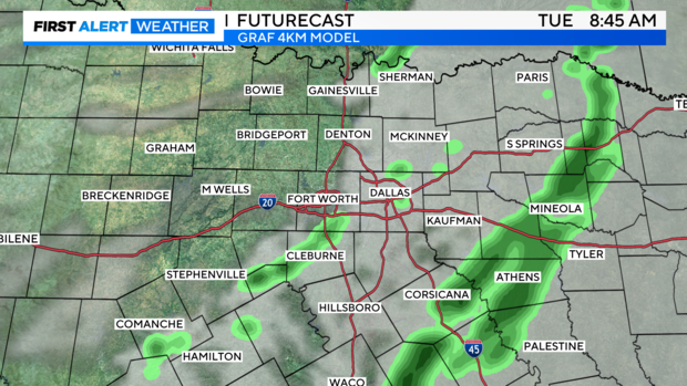
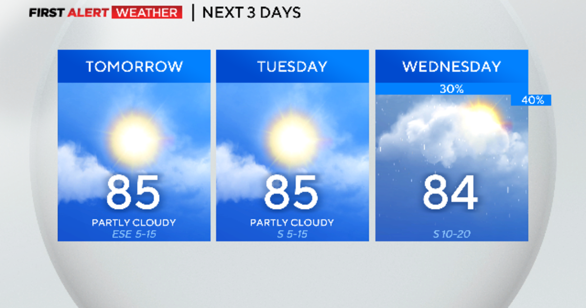
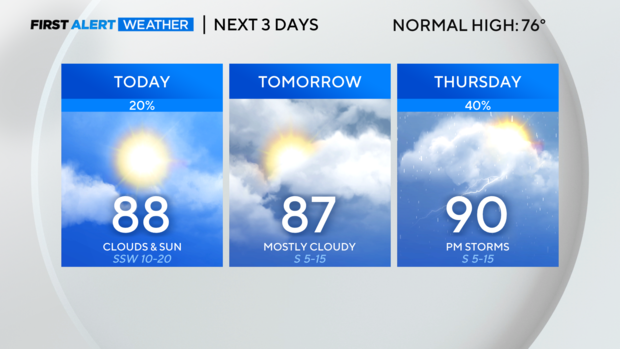
We're not expecting a washout but an isolated strong storm is possible with gusty winds and lightning. Otherwise, expect a mix of clouds and sunshine. Highs will be in the mid to upper 80s. Winds will be a bit breezy from the southwest between 10 and 20 mph.
Tonight, we'll see partly to mostly cloudy skies. Lows will be in the upper 60s.
On Wednesday, we'll see mostly cloudy skies. Highs will be in the mid to upper 80s.
Highs will be near 90 degrees on Thursday! We'll also see another round of potentially strong thunderstorms in parts of North Texas this Thursday. The threat for severe storms will be conditional upon the CAP and a dryline to our west.
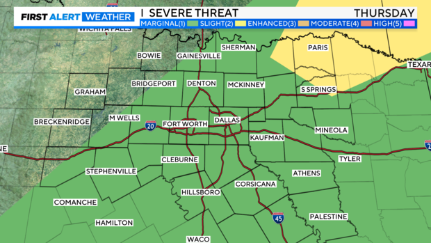
For now, the forecast calls for strong storms that could produce large hail and gusty winds by Thursday afternoon and evening.

Once the front is to our south on Friday, our highs will sink into the low 70s. There is a slight chance of a shower Friday, but more wet weather will push in Friday night into Saturday.
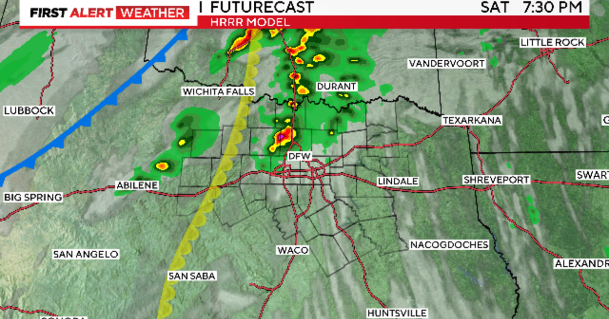
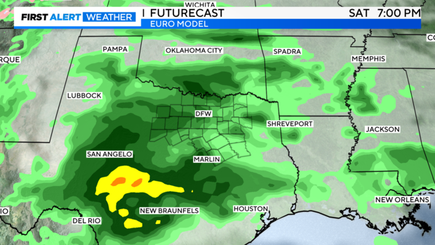
In fact, we'll likely see more widespread rain and storms on Saturday. Let's watch out for periods of heavy rain, which could produce some localized flooding.
High temperatures will be in the mid-60s on Saturday, then in the lower 60s on Sunday. A few early showers are possible on Sunday.