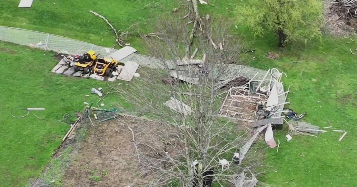
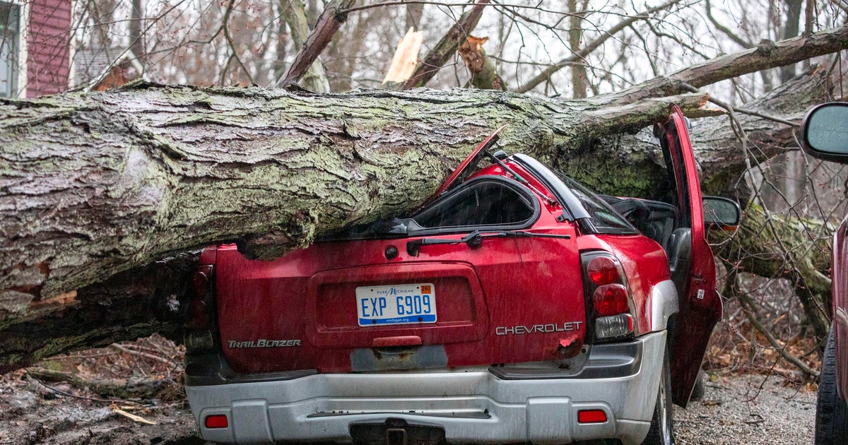
Threat of tornadoes, damaging winds, hail possible on Thursday

NORTH TEXAS (CBSNewsTexas.com) – We've been threatened with severe weather several times so far this year. Thursday is the highest threat of tornadoes so far:
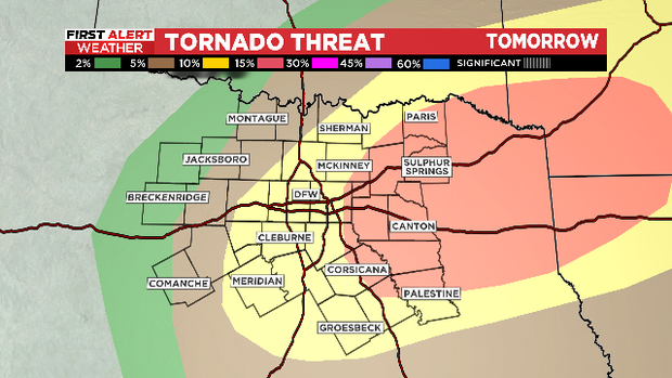
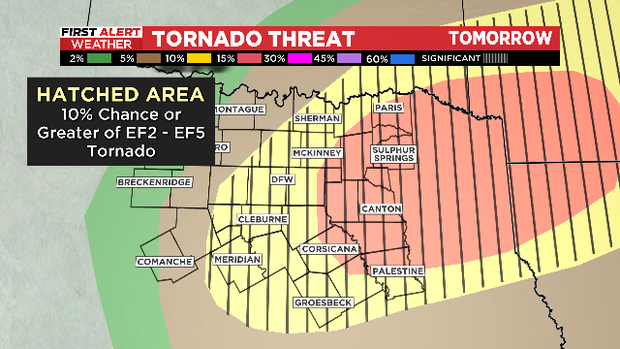
Of even greater concern, for the first time this year the Metroplex is under the "hatched area." Those black lines mean there is a threat for rotating supercells that can produce tornadoes with winds 118 mph or higher (EF2 or above).
Make sure to stay weather aware Thursday afternoon and evening. Do you know the safest place in your house? If you are in your car when the storms hit, pull over and find shelter in a building. Absolutely do NOT park under an overpass, those places actually channel the damaging winds.
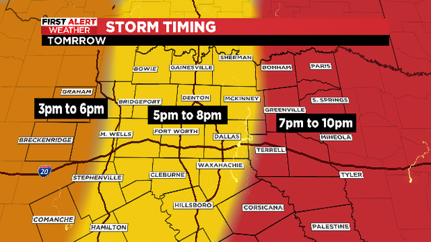
Here is the approximate timing for the storms coming through. The low pressure system causing our severe weather outbreak is moving right over North Texas. This makes the forecasting of storm timing very difficult. You need to pay attention to the time windows instead. There is a chance the worst of the storm could rapidly develop just to the west of the Metroplex if not directly overhead:
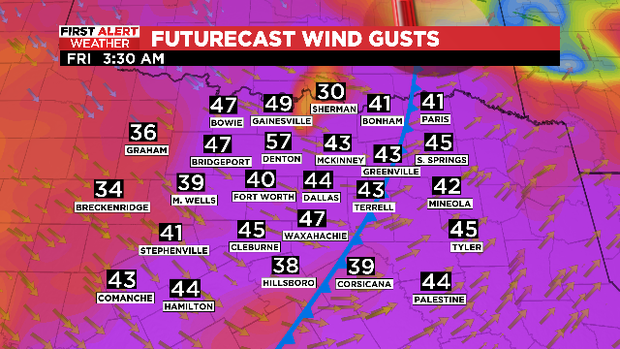
Large hail and damaging winds are of great concern as well. The higher risk of severe weather Thursday is on the east side of the I-35 corridor. Once the storm clears please be aware that VERY strong winds will move in BEHIND the front. These are not STORM WINDS but steady winds from the west veering northwest. Gusts could hit close to 50 mph overnight into Friday morning.
If your trash pick-up day is on Friday, it would be best to wait until later in the morning to set your cans out.
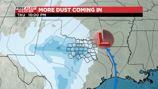
As the low pressure system moves off to our east, it is going to pull into North Texas some dust from West Texas.
Thursday could be a dangerous day across North Texas. The First Alert Weather team will be providing hourly updates until the severe weather starts, then be on the stream and CBS News Texas across the afternoon and evening to keep you safe.