First Alert Weather: Damaging winds, hail & tornadoes possible
April 4 is a First Alert Weather Day, with the greatest chance for severe weather across North Texas between 4:00 p.m. and 2:00 a.m..
All modes of severe weather are possible – damaging winds, large hail and tornadoes - with an Enhanced Risk for the Metroplex.
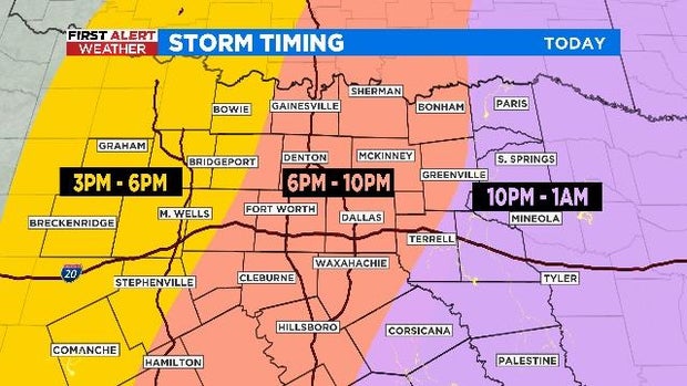
The large hail and tornadoes are of course the main concern when the storms initialize in our western counties and are of a more discrete supercell nature.
The storms are expected to become more linear and form a squall line as they move east into the Metroplex, with the highest threat of damaging winds between 60-70 mph.
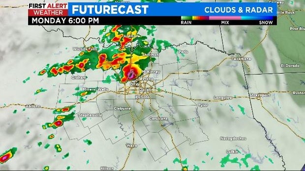
There is also a chance for a few quick spin up tornadoes along the line.
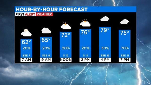
Before the storms arrive Monday afternoon/evening it will be a mostly cloudy day with highs near 80°.
The severe weather threat ends as the line moves into East Texas early Tuesday morning. Strong southwest winds will develop Tuesday, bumping temperatures into the upper 80s with mostly sunny skies.
A dry cold front slides in Tuesday night, shifting winds from the north and drawing in cooler air.
Temperatures return closer to seasonal on Wednesday through the end of the workweek -- topping out near 70°.


