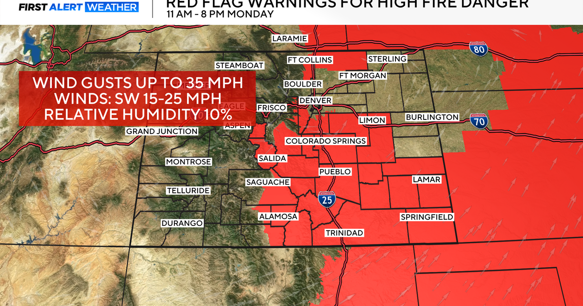
Extreme Fire Danger Leads to Red Flag Warnings West of Fort Worth
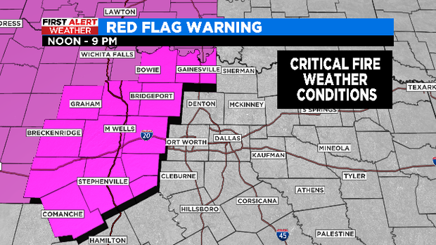
NORTH TEXAS (CBSDFW.COM) - Critical fire weather conditions are expected Sunday afternoon across the western parts of North Texas, prompting the National Weather Service to issue a Red Flag Warning for a dozen counties to the west of of DFW.
WHAT WE'RE WATCHING:
1) Red Flag Warning today (critical fire weather conditions)
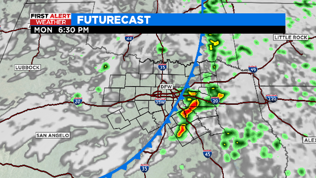
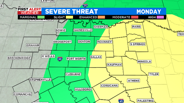
2) Cold front arrives Monday afternoon; strong-severe storm potential (east of I-35E)
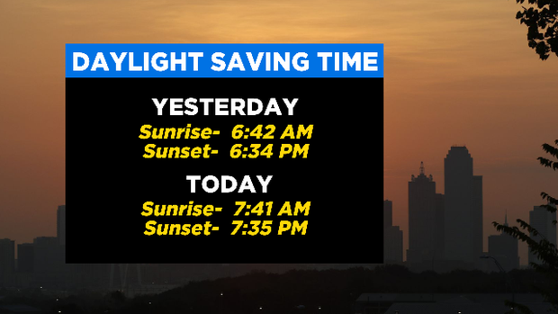
Hope everyone is having a wonderful weekend and enjoying all the sunshine!
Thanks to our time change overnight, we'll see the sun set about an hour later this evening as our days become longer. The flip side of that - our sunrise is also a bit later now, so it will be dark out for the morning commute tomorrow!
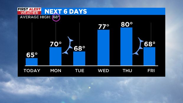
TODAY:
• Sunny, warmer, and breezy with highs in the mid 60s (close to average)
• A Red Flag Warning has been issued for locations west of I-35W from noon until 9 PM tonight
• Critical fire weather conditions are anticipated thanks to southerly winds gusting up to 35 mph combined with warmer temps, dry vegetation, and very low humidity.
MONDAY:
• Clouds increase, breezy, and warm near 70º
• Isolated drizzle early in the day
• Next cold front arrives by the afternoon
• Scattered strong-severe storms could develop by early evening and race out of NTX by midnight
• Threats: Large hail, damaging winds
Source: CBSDFW
Aside from a couple of fronts and occasional storm chances, the week ahead is a big improvement! After our tough stretches of winter weather, this week is all about spring with temperatures running around or above average.