Cloudy Skies, Scattered Showers Ahead Of Arctic Front Arriving Friday
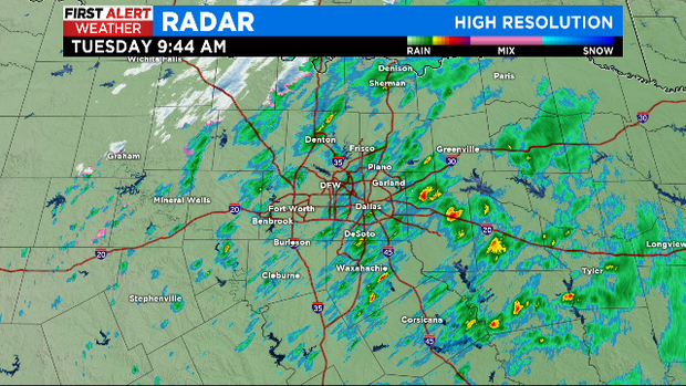
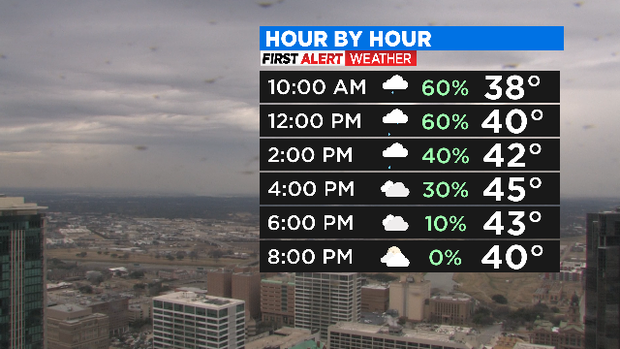
NORTH TEXAS (CBSDFW.COM) - We're watching another raw winter day today with cloudy skies, well below average temps and scattered showers. Expect an Arctic front/precipitation to arrive by Friday (cold rain with some sleet and possible snow mix).
TODAY:
Scattered showers remain morning-afternoon
Mostly a cold rain with occasional sleet/graupel mixed in (mainly west of I-35W)
Rain shifts mostly east of I-35E by early afternoon
Running around 20 degrees below average with highs in the 40s
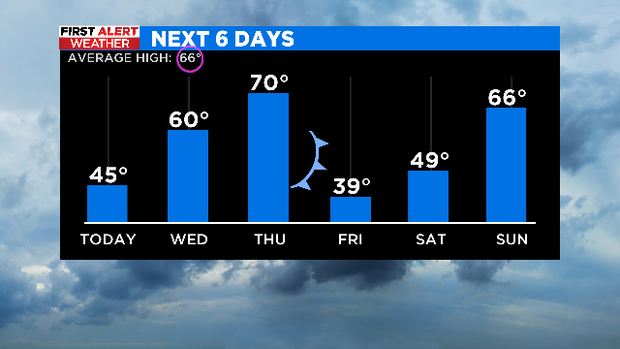
THURSDAY NIGHT-FRIDAY:
Strong arctic front arrives, flipping our pattern from spring back to winter.
Wet weather appears likely
Cold rain looks like a good bet with some winter mix of sleet/snow possible during the day Friday
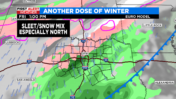
I know we're all weary from the winter season this year (no one feels this more than our weather team. But don't panic just yet! There's still a lot to iron out with this late week storm. As of right now, our forecast doesn't call for temps below freezing Thursday-Friday when the showers are moving in. Also, we'll have a mild Thursday ahead of this system which should help roads to thaw out ahead of time. So while we do think parts of NTX will see some winter precip., there's a lot of uncertainty on if it will accumulate/have a travel impact.