Spring storm soaks Northern California; winter storm warning in Sierra
A spring storm continued to soak Northern California Tuesday morning, bringing rain to Central Valley and snow to the Sierra.
As of about 8 a.m., the heaviest rain was falling in the Sierra foothills, from Nevada County down to Calaveras County, along with areas east of Modesto and Turlock.
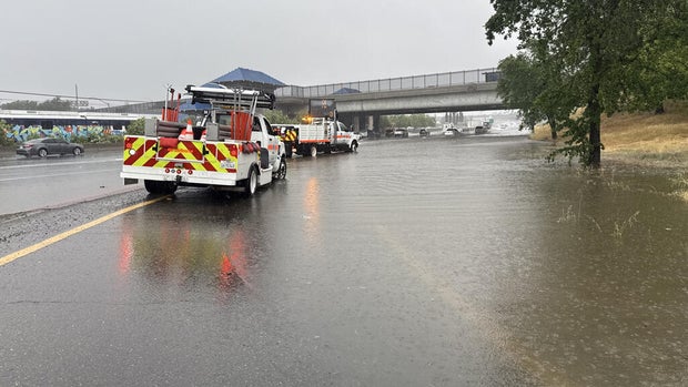
The rain has also led to minor flooding on Interstate 80 near Watt Avenue, according to the California Highway Patrol.
Heading into the afternoon, forecasters said to expect additional showers along with the possibility of thunderstorms. Hail, brief heavy rain, gusty winds and potential funnel clouds and isolated weak tornadoes are possible.
According to the National Weather Service, thunderstorms are most likely between 10 a.m. and 8 p.m.
First Alert Weather: Current conditions, alerts, maps for your area
In the Sierra, a winter storm warning remains in effect through 5 p.m. Wednesday. Snowfall rates of up to 1-2 inches per hour is expected through Tuesday night. Up to 12 to 18 inches of snow is expected above 5,000 feet elevation, with up to 2 feet of snow on the highest peaks.
Meanwhile, up to 2 inches of snow is possible down to 4,500 feet in elevation.
Forecasters said travelers in the Sierra should expect significant reductions in visibility and the potential for major travel delays.
The California Highway Patrol said chain control was in effect as of 10:43 a.m. on Interstate Highway 80 over Donner Summit.


