Pittsburgh to have warmer temperatures Thursday with possible strong storms looming
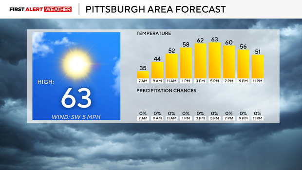
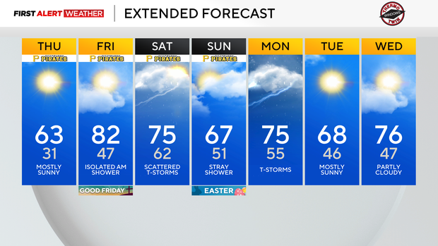
Today will be sunny and pleasant for the afternoon. I have highs hitting 63 degrees. Some high clouds will begin to come back after 4 this afternoon. There will be a brief and low rain chance before sunrise on Friday as a warm front sweeps through. This will push highs on Friday up to the 80s.
We won't be anywhere near the record high of 90 degrees on Friday but is anyone complaining?
WEATHER LINKS:
Current Conditions | School Closings & Delays | Submit Your Weather Photos
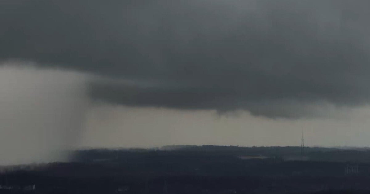
Storm chances are up on Saturday with fast-moving storms possible. All forms of severe weather will be on the table, including large hail, destructive straight-line winds, and even a tornado. Highs on Saturday will likely still hit the upper 70s, even with the storm and rain chance.
Easter Sunday will see a low rain chance throughout the day, with light rain and drizzle both possible.
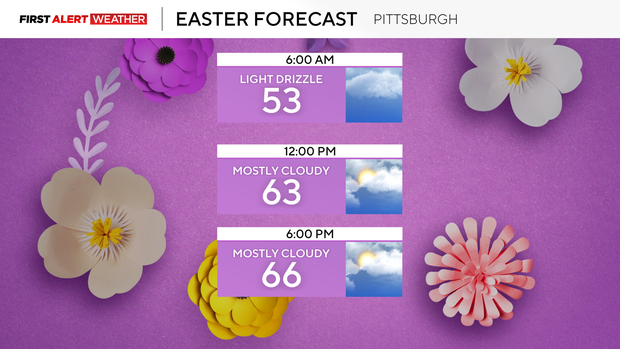
I have Easter highs hitting the upper 60s with lows in the low 50s.
It has been a wet start to April so far, and it has been great for abnormally dry conditions across our area.
Not only did we receive bountiful rain, but it was mostly a light to moderate, steady "soaking" rain that didn't allow a lot in the way of runoff. This has pushed our U.S. Drought Monitor weekly maps to go from around 44 percent of our area being "abnormally dry" to last week seeing just 6 percent of our area being under the same conditions.
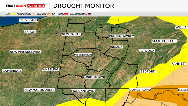
If you're wondering where these stats come from, I am using the U.S. Drought Monitor NWS Pittsburgh Forecast Area for the data. New maps come out at 8:30 this morning.
If the abnormally dry conditions in Forest County are gone when it comes out, then we would be 100 percent drought condition-free.
The last time that happened was May 28th of 2024.
Stay up to date with the KDKA Mobile App – which you can download here!