Flash flood risk in place in the Pittsburgh area on Sunday | First Alert Weather

There's a flash flood risk in place for today, with places south of Pittsburgh seeing the highest risk. Communities to the north of Pittsburgh will also see rain, but showers will be more scattered to isolated in nature; rain rates won't be as high, and showers won't last as long.
This should limit the flood risk for these communities.
South of Pittsburgh, and especially south of I-70, it's another story. As of 5 a.m., we have already seen our first flash flood warning of the day. Radar estimates up to 2.5" of rain fell in parts of Washington County, stretching west into Ohio. The heaviest rain fell just north of I-70, along state highway 844. Communities like West Middleton, near the Highland Springs Golf Course, and just south of Wellsburg, WV saw the highest rain totals.
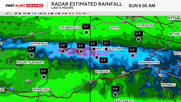
The good news is that no storm reports have come out yet for this area. If you see high water on roads, please turn around and don't risk being stuck or swept away.
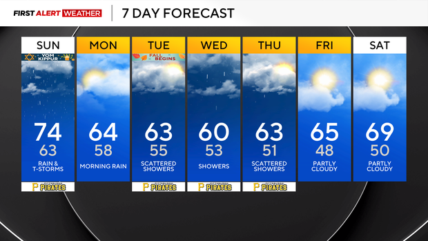
Looking ahead, today's rain chance will be highest this morning. Another push of rain will occur early on Monday morning as well. Expect a wet start to the day with rain totals again highest south of Pittsburgh.
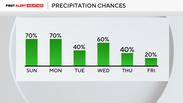
Model data continues to show the possibility of a couple of places seeing rain totals of more than 2 inches. With all the rain we have seen over the past 6 weeks, any heavy rain could potentially lead to flash flooding.
The other big story is the quick flip of the switch into fall weather.
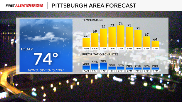
Highs today will hit the mid-70s with morning temperatures in the mid-60s. Our daily low will be reached just before midnight; I have Pittsburgh at 63° at midnight. Monday morning temperatures will dip down to the 50s(!!), before we warm up to the mid-60s(!!) for highs. Most of Monday's rain will fall before 10 a.m.
Rain chances will be lower Tuesday through Thursday, but there still will be some rain around. Highs during that stretch will be in the mid to low 60s. The autumnal equinox, the official start of fall, is at 8:05 p.m.