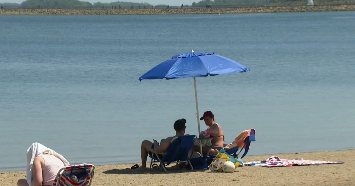
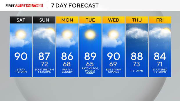
Isolated storms in the Pittsburgh area this afternoon ahead of a hot weekend

This morning begins unseasonably warm and very humid across most of Western Pennsylvania, with temperatures that have struggled to drop below 70°F in the Pittsburgh metro area.
WEATHER LINKS:
Current Conditions | School Closings & Delays | Submit Your Weather Photos
Southerly flow near the ground and a warm air mass building above ground will set us up for a hot afternoon with several spots reaching near 90 degrees. We don't really have a strong source of lift to get storms going, but there is the possibility of some isolated activity on the westward-facing slopes of the ridges and for some of our westernmost counties that border Ohio by late afternoon and early evening.
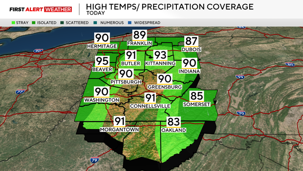
Outside of that, partly cloudy skies and winds out of the south to southwest between 5-10 mph are expected.
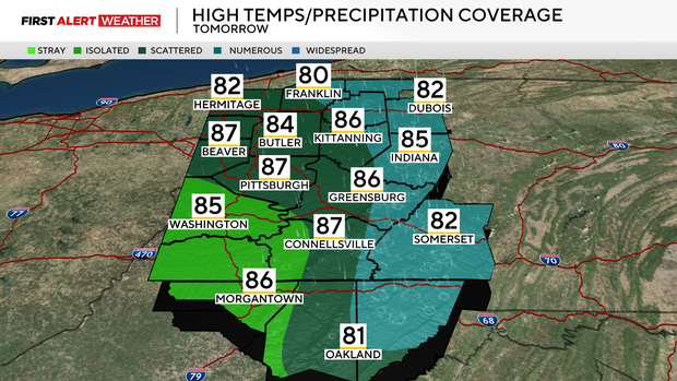
Another very warm and humid morning is expected on Sunday, with air temperatures struggling to drop below 70 degrees in the Pittsburgh metro. A weak trough will move into the area by midday into the early afternoon, triggering scattered storms, meaning not all of our area will see rain, but 50-60% will.
The best chance of storms will be from Pittsburgh and points northeast, with much lower coverage for locations south and west of Pittsburgh. Gusty outflow winds and microbursts may accompany storms, especially during their weakening phase. Heavy rain and localized flash flooding will also be a threat with any cells, especially for areas in and east of the Laurel Highlands moving into Central Pennsylvania.
The cold front with this system will move into our area by late Sunday evening, but it will fall apart over our location. The trend of precipitation for Monday has been decreasing now as high pressure and some drier air will settle in. Temperatures will be a degree or two cooler on Sunday and Monday with highs in the mid-80s, but due to a lack of cool air moving in behind this boundary, we will quickly spike back up to the upper 80s to near 90 by Tuesday and Wednesday.
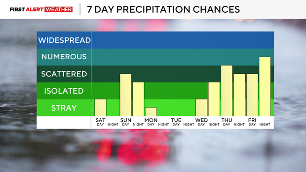
High amounts of moisture are expected to return to our area by the middle to end of next week, and a series of disturbances moving in from the west will trigger daily shower and storm chances starting late Wednesday evening. The highest coverage will likely be on Thursday and Thursday night. Flash flooding and low severe weather risks cannot be ruled out during this time period.
Stay up to date with the KDKA Mobile App – which you can download here!