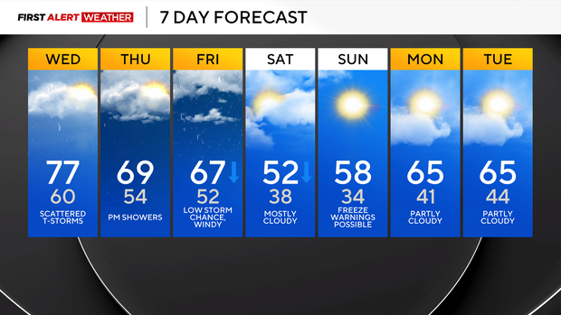
Storms and severe weather possible in the Pittsburgh area this week as cool front sweeps through

There's a chance of storms today as a cool front slides through our area. The actual front will move through around 3 p.m., and that will also be the peak chance for severe weather in Pittsburgh.
Looking through model data, the current GRAF model run is the worst-case scenario for Western Pennsylvania, with communities from the city of Butler to the south being dry through 10 a.m. and temperatures rapidly warming up ahead of the frontal passage early in the afternoon.
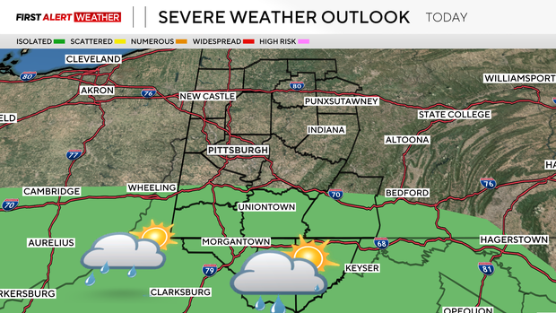
In this scenario, most of Allegheny County is dry through around 2 p.m. this afternoon, with storms firing rapidly off of the front as it moves to the south. I expect that the marginal risk that is currently in place for communities south of I-70 will be extended to the north if more data starts to agree with our morning hours being dry.
Strong winds, lightning, and brief downpours are the biggest concerns for today.
While the GRAF model is the most aggressive for today, there are some issues that I have with its timeline. Other models show a higher chance for morning clouds and brief rain, keeping atmospheric conditions that are more stable in place for communities north of I-70. The HRRR model is once again doing a good job of showing what is most likely to occur today, with a couple of scattered showers and isolated non-severe storms occurring during the morning commute. The farther one is to the north, the higher the chance of seeing a scattered shower.
Places south of Pittsburgh should be dry for the morning. Unfortunately, most data is showing storms firing off of the cold front for communities south of I-70 today, with the HRRR model showing storm formation occurring after 6 p.m. right along the WV-PA state line and storms moving to the south.
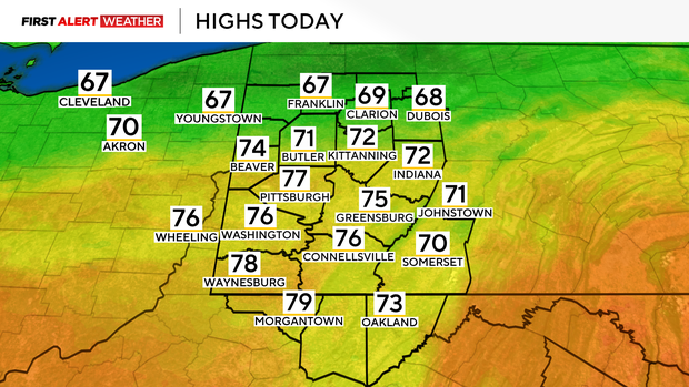
Besides the wildcard of when rain will arrive, the rest of the forecast is fairly straightforward for today. Highs will be reached around 3 p.m. and should be in the mid to upper 70s. By 6 p.m., temperatures will be down to around 70°. I have midnight temperatures at around 60°.
Thursday's rain chance will be isolated, with a pleasant afternoon expected with highs near 70 degrees. There will be some scattered showers around for the late afternoon to evening.
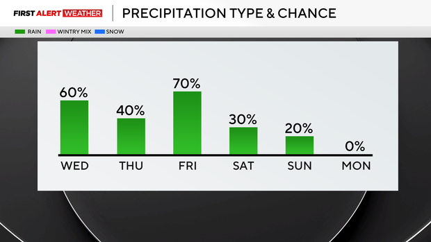
Rain chances go up on Friday morning as another cold front sweeps through.
Cold air will continue to roll in on Saturday, with us going from Friday morning temperatures in the 60s to morning temperatures in the mid- to low-30s on Sunday morning.