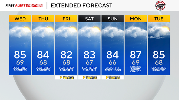
Scattered rain chances return to Pittsburgh this afternoon and persist through the week

Morning temperatures are around 10 degrees warmer this morning than yesterday morning as humidity returns today.
Humidity levels, along with rain chances, return today. The best way to look at humidity is through the dew point, a measure of moisture at the surface.
Yesterday's dew point held around 60°. The dew point will be near 70° this afternoon and is in the mid-60s this morning. Humidity levels should stay near 70 degrees, what we consider a tropical airmass, through at least Monday. High humidity levels are needed for storms, with air moisture adding to instability. Higher humidity levels also slow your body's natural ability to cool itself.
This feeling of being "stuffy" is due to more moisture in the air slowing the cooling process of evaporation. You are going to notice the change when you are outside today.
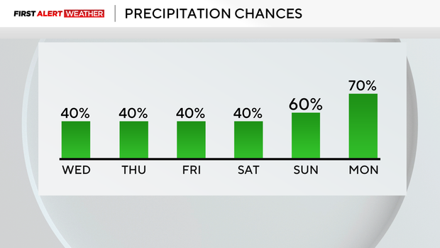
When it comes to our storm chances, today will not be a washout. In fact, I don't think any day will see rain start to finish or even most of the day. Rain chances each day will spike in the afternoon, with lower isolated rain chances in the overnight and morning hours.
Severe weather chances remain low but can't be ruled out. Strong wind speeds would be the most likely issue there.
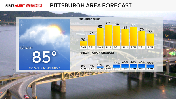
When it comes to your forecast, I have high temperatures hitting the mid-80s today. Yesterday's high temperature hit 86°, and I think we will be near there. I am dropping our high, though, to 85°. Higher humidity values (moist air requires more energy to warm), more cloud cover, and the chance for rain should keep our temperatures near 85°.
I have noon temperatures already in the mid-80s too.
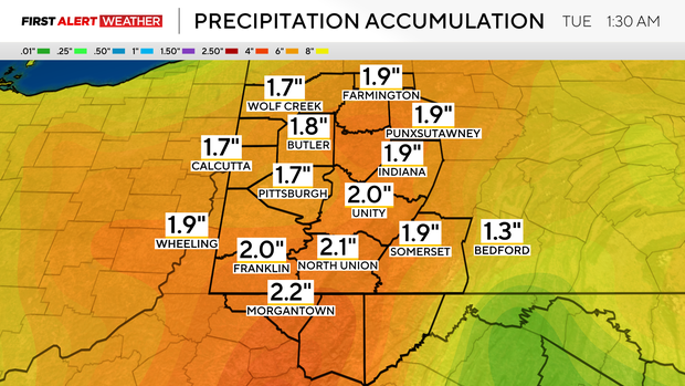
We can rinse and repeat this forecast for the next couple of days, through Saturday. Rain chances will then go from scattered to more widespread Sunday and Monday.