Pittsburgh's warm-up continues with pleasant weather on Wednesday
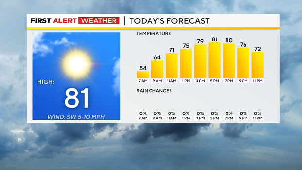
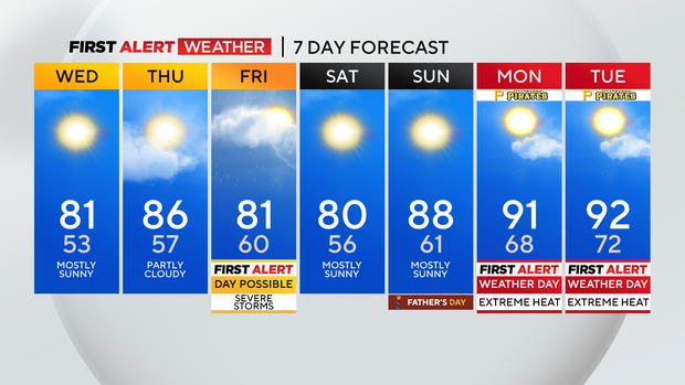
PITTSBURGH (KDKA) - While we won't be as cool as we have been the past couple of days, pleasant weather sticks around for another day with highs near 80 degrees today.
The biggest concern today is some patchy morning fog for some places north of Pittsburgh. Fog could be around as late as around 8 a.m. Besides that skies will remain sunny today overall with some brief cloud cover possible during the morning hours.
WEATHER LINKS:
Current Conditions | School Closings & Delays | Submit Your Weather Photos
Morning lows are in the mid to low 50s.
The warm-up continues on Thursday with highs returning to the mid-80s. I have Pittsburgh's high hitting 86°.
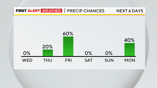
Thursday really looks completely dry at this time but I will continue with an isolated rain chance for the afternoon. Morning lows on Thursday should dip down to just below 60° as humidity levels slowly begin going up.
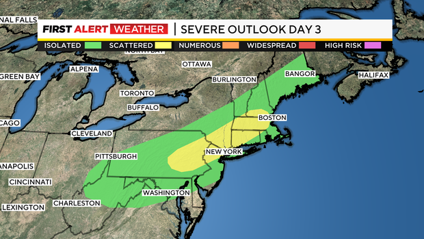
All week long it appeared that we would see a cold front passing by on Friday morning while most were sleeping. While a lot of data continues to show this as the likely solution, some data including our own inhouse model is showing the passing up of the cold front now happening in the afternoon. This ups our storm chances as the system slides through and indeed we are under a 'marginal' severe weather risk according to NOAA's Storm Prediction Center.
This is a level one out of five when it comes to the "severe weather ladder" with five being the highest.
At this point, strong wind and large hail are the biggest concern. There will be adequate shear for us to also have to mention a tornado can't be ruled out.
Frequent lightning and downpours also should be expected as the front passes by during the afternoon. Rain and storm chances won't last long for most places as the front moves south. Places south of I-70 could see higher rain totals however as the front potentially stalls.
This will also mean severe weather risks will be highest to the south and east. While things can change the severe weather window will be from 2 p.m. through 8 p.m. on Friday.
The "heat dome" is still set to impact us next week with hot weather arriving as soon as Sunday afternoon. I have Sunday highs just shy of 90 degrees but we could hit the 90s on Sunday.
I don't think we will though.
90s will be possible on both Monday and Tuesday though. In fact, we will have a chance to hit the 90° mark starting on Sunday and going through the next Sunday.
Please be prepared.
Stay up to date with the KDKA Mobile App – which you can download here!

