Flash flooding risk continues on Thursday with scattered storm chances also possible

The risk for flash flooding remains in the forecast today due to the threat of slow-moving but heavy rain-producing storms.
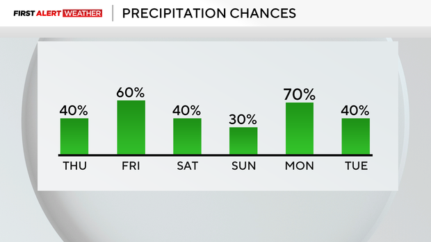
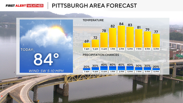
The highest rain and storm chance comes from 11 a.m. through 5 p.m. today. Model data does not show a lot of rain for today, but the setup is clearly there for flash flooding.
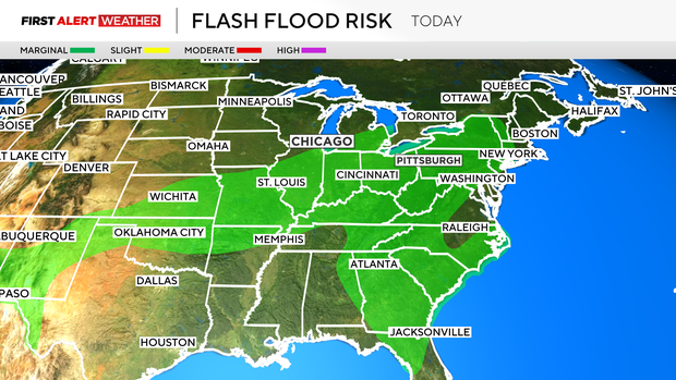
We have high humidity levels with precipitable water values coming in at 1.93". That is a very saturated atmosphere and means if you see rain today, there's a high likelihood it will be 'heavy.' Similar to yesterday, most people won't see more than a quarter of an inch of rain, but there will be some that see near an inch of rain.
There will also be isolated spots that could see near 3 inches of rain, which radar estimated for rain amounts in places like Salt Lick in Fayette County.
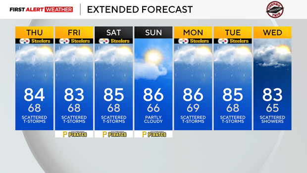
This same setup will be in place through at least next Monday with a cold front nearing us from the northwest and bountiful moisture moving in from the Gulf Coast. Highs hitting the mid 80s each and every day should lead to explosive, slow-moving storms with rain totals that can quickly add up.
Highs today will hit the mid 80s again, with noon temperatures near 80 degrees. Humidity levels are on the high side, with dew points hovering near 70°. It'll be muggy for the entire day. Winds will be out of the southwest at around 10 mph.
Looking ahead, temperatures will remain in the mid 80s for most of the next week, with morning lows also not changing very much. Most will see morning lows in the mid to upper 60s each day. Our highest severe storm chance looks to come on Monday.