Pittsburgh in for more accumulating snow followed by very cold air this weekend
Temperatures are 10-20 degrees colder across western Pennsylvania and northern West Virginia this morning in the wake of a strong cold front that passed through Wednesday evening. All locations are below freezing, so be on the lookout for black ice and any refreeze, especially on untreated surfaces.
WEATHER LINKS:
Current Conditions | School Closings & Delays | Submit Your Weather Photos
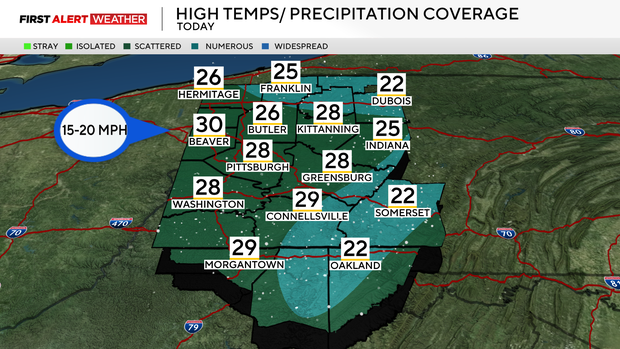
Some lake-enhanced and upslope snow showers are expected areawide today with the higher coverage along and north of I-80 and in the Laurel Highlands and Ridges. Additional accumulation will generally be 1" or less in most areas. Winds today will not be as gusty as previous days, but still brisk out of the west, around 15-20 mph.
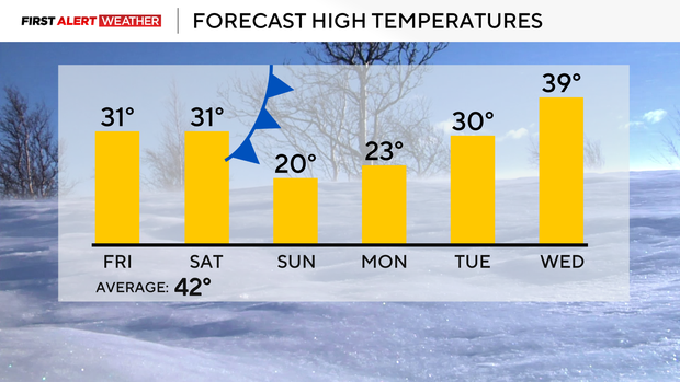
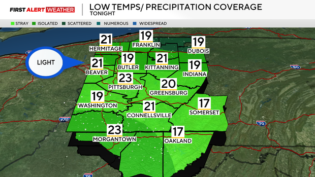
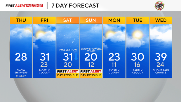
The snow showers will taper off after sunset into the overnight hours with lows on Friday morning generally in the low 20s, possibly a few teens as well. Most of Friday will be overcast, with some partial clearing Friday afternoon and evening. Highs on Friday will likely reach the upper 20s to low 30s areawide.
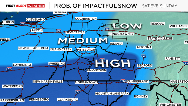
The next impactful storm system is poised to arrive in our region Saturday night. As of Thursday morning, the system is in the Gulf of Alaska, but is generally expected to track southeast into Canada and move through the Midwest and Ohio Valley this weekend.
Since this system is currently in a spot where there are few observations and data that can be fed into the models, this means it is still a bit early to get into too much detail regarding snowfall amounts. However, when we account for uncertainty using model ensemble members and an average of potential outcomes, the probabilities of impactful snow and accumulation are increasing, especially over the southern half of our forecast area.
Areas generally from I-70 south toward I-68 have the greatest potential of receiving at least a moderate snow, with higher amounts likely in the Ridges of southwestern Pennsylvania and northern West Virginia. The timing for this will generally be Saturday afternoon through Sunday morning.
A very cold air mass will move in behind this system on Sunday, with highs struggling to get out of the teens and lows generally in the single digits to low teens. Wind chills could be below zero on Sunday and Monday morning in spots. Well below normal temperatures will linger into early next week before a pattern shift by the middle to end of next week, with temperatures getting closer to normal.
Stay up to date with the KDKA Mobile App – which you can download here!