AP Photo/NASA
A NASA image shows Mars Exploration Rover Opportunity using its front hazard-identification camera across the Victoria Crater on Sept. 27, 2007. Mars formed more than 4.5 billion years ago, and scientists generally believe it went through an early wet and warm era that ended after 1.5 billion to 2.5 billion years, leaving the planet extremely dry and cold.
AP/NASA
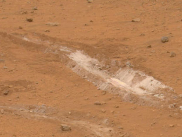
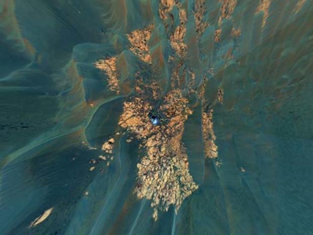
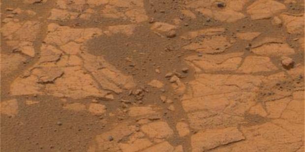
A patch of bright-toned soil is found by Mars Rover Spirit in an image released on May 21, 2007. The robot analyzed a patch of soil in Gusev Crater and found it unusually rich in silica. The presence of water would have been necessary to produce such a large silica deposit, according to scientists.
Victoria Crater
AP Photo/HO/NASA
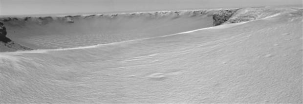
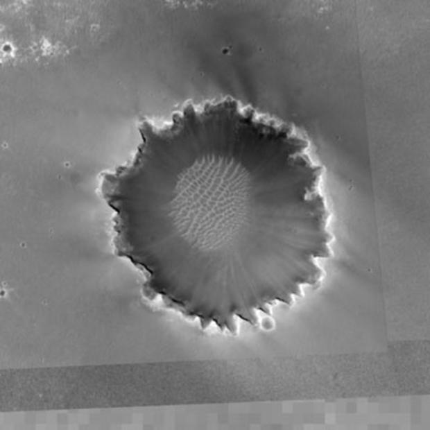
NASA's Mars rover Opportunity made this panoramic view of Victoria Crater in Mars' Meridiani Planum region after an 85-foot drive during the rover's 951st Martian day, Sept. 26, 2006. After the drive, the rover's navigation camera took the three exposures combined into this view of the crater's interior. The bottom of the crater is covered by sand that has been shaped into ripples by the Martian wind.
AP Photo/NASA
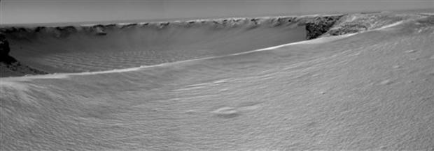
This photo by the Mars rover Opportunity's navigation camera Tuesday, Sept. 26, 2006, shows three exposures combined the into a panoramic view of the rim of Victoria Crater in Mars' Meridiani Planum region. The rover wheeled to the rim of a half-mile crater after a difficult 18-month journey. The rim is composed of alternating rocky points towering approximately 230 feet above the crater floor and recessed alcoves.
NASA/JPL-Caltech/MSSS
An image from the Mars Orbiter Camera aboard NASA's Mars Global Surveyor spacecraft shows an overview of "Victoria Crater" and a portion of the area that rover Opportunity has covered to reach the enormous depression. The crater is about half a mile in diameter, about five times wider than the stadium-sized "Endurance Crater," which Opportunity spent six months examining in 2004.
NASA/JPL-Cal Tech/Cornell
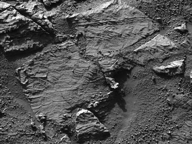
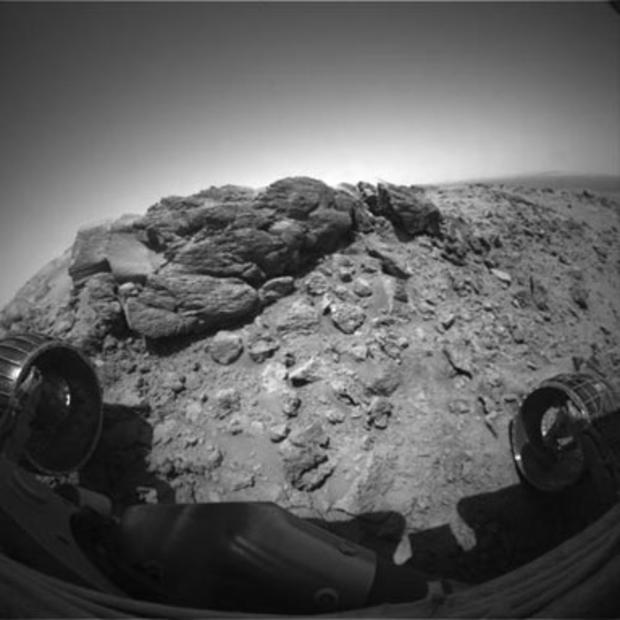
This image from the panoramic camera on NASA's Mars Exploration Rover Opportunity shows the best examples yet seen in Meridiani Planum outcrop rocks of well-preserved, fine-scale layering and what geologists call "cross-lamination." Opportunity acquired this image of a rock called "Overgaard" at the edge of "Erebus Crater" during the rover's 690th Martian day, Jan. 2, 2006.
NASA/JPL/CORNELL
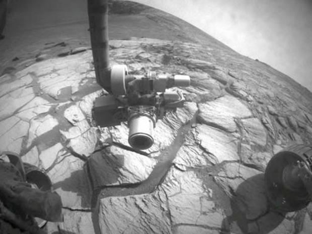
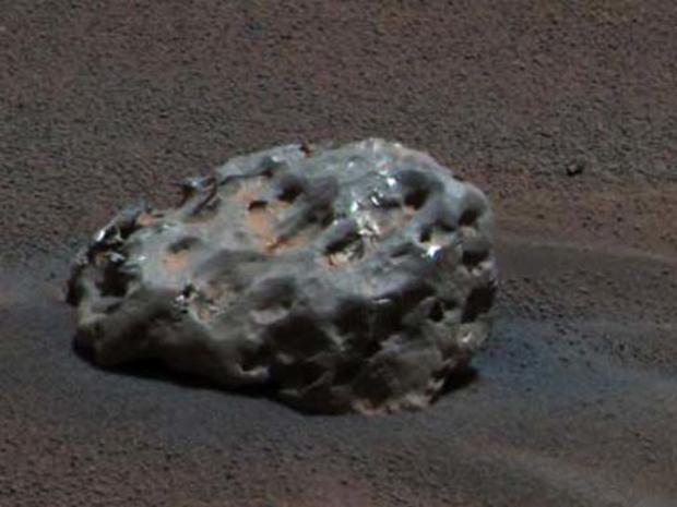
On Jan. 6, 2005, NASA's Mars Exploration Rover Opportunity found an iron meteorite on Mars, the first meteorite of any type ever identified on another planet. The pitted, basketball-size object is mostly made of iron and nickel.
CBS
While descending "Husband Hill," NASA's Mars Exploration Rover Spirit took the most detailed panorama so far of the "Inner Basin," the rover's next target destination. Spirit acquired the 405 individual images that make up this 360-degree view of the surrounding terrain using five different filters on the panoramic camera. The rover took the images on Martian days, or sols, 672 to 677, Nov. 23 to 28, 2005.
NASA/JPL-Caltech/MSSS
Shortly before Spirit celebrated its first Mars-year anniversary (687 Earth days) in Nov. 2005., the Mars Orbiter Camera on NASA's Mars Global Surveyor acquired an image covering approximately 1.9 miles by 1.9 miles centered on the rover's location at that time in the "Columbia Hills." "Husband Hill," the tallest in the range, is just below the center of the image.
NASA/JPL-Cal Tech/Cornell
This view combines frames taken by Opportunity's camera on the rover's 652nd through 663rd Martian days, or sols (Nov. 23 to Dec. 5, 2005), at the edge of "Erebus Crater." Opportunity examined targets on the outcrop called "Rimrock" in front of the rover, testing the mobility and operation of Opportunity's robotic arm.
NASA/JPL-Cal Tech/Cornell
This image of "Erebus Crater", taken by Opportunity's camera on the rover's 652nd through 663rd Martian days, Nov. 23 to Dec. 5, 2005, shows outcrop rocks, sand dunes, and other features out to a distance of about 82 feet from the rover.
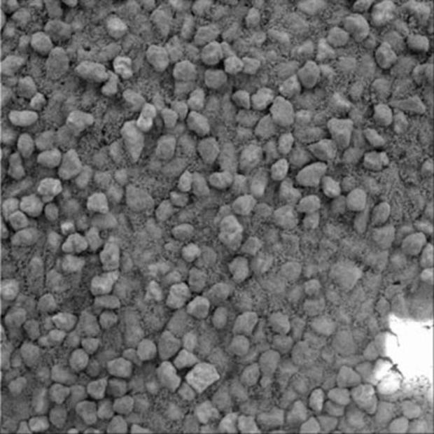
NASA/JPL/CORNELL
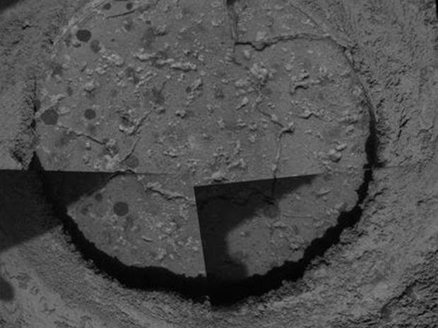
This microscopic image of a drill hole cut into a Martian rock nicknamed "Ice Cream" by the rover Opportunity's rock abrasion tool shows cross sections of round concretions 1 to 2 millimeters (0.04 to 0.08 inches) wide. Science team members are debating whether the grayish-looking smudges that are not as round are concretions or some other feature.
NASA/JPL-Caltech/Cornell
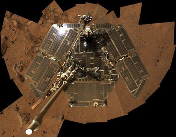
The most recent self-portrait of NASA's Mars Exploration Rover Spirit shows the solar panels still gleaming in the Martian sunlight and carrying only a thin veneer of dust two years after the rover landed and began exploring the red planet. Spirit's panoramic camera took this mosaic of images on the 586th sol, or Martian day of exploration, Aug. 27, 2005.
CBS
Spirit completed a difficult, rocky ascent en route to reaching a captivating rock outcrop nicknamed "Hillary" at the summit of "Husband Hill" on Martian day 625, Oct. 6, 2005. At the end of the climb the robotic geologist was tilted almost 30 degrees. To get the rover on more solid footing for deploying the instrument arm, rover drivers told Spirit to wiggle its wheels one at a time.
CBS
This image of grains in a sand drift was informally named "Cliffhanger" because of its proximity to the edge of steep slopes that bound the summit region of "Husband Hill," highest of the Columbia Hills. Spirit took the image with its microscopic imager on the rover's 607th Martian day, or sol, Sept. 9, 2005.
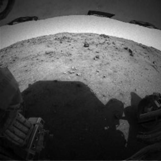
NASA/JPL
A photo taken by the rear hazard-identification camera on Spirit shows the last few days of the rover's ascent to the crest of "Husband Hill" inside Mars' Gusev Crater. The rover was going in reverse. Rover planners often drive Spirit backwards to keep wheel lubrication well distributed.
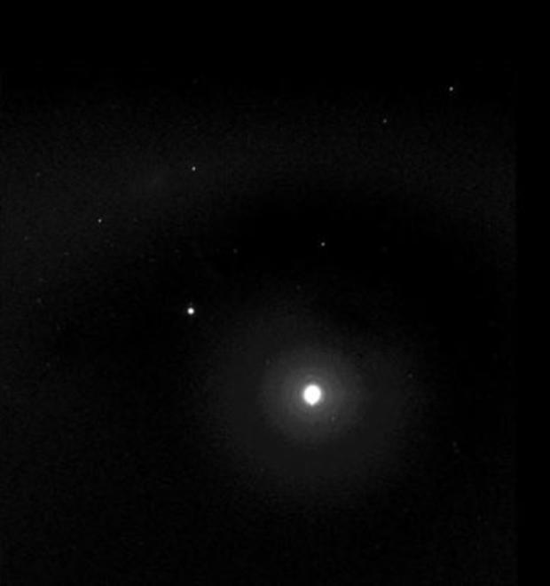
NASA/JPL/Cornell/ Texas A&M
Taking advantage of extra solar energy collected during the day, NASA's Mars Exploration Rover Spirit settled in for an evening of stargazing, photographing the two moons of Mars as they crossed the night sky on sol 585, Aug. 26, 2005. Scientists will use the image to better map their orbital positions, learn more about their composition, and monitor the presence of nighttime clouds or haze.
CBS
A bulbous texture is evident in this rock target at the outcrop called "Jibsheet" in this view from the microscopic imager on NASA's Mars Exploration Rover Spirit. Frames making up this mosaic image of a target dubbed "Reef" were taken during the rover's 481st Martian day, May 11, 2005.
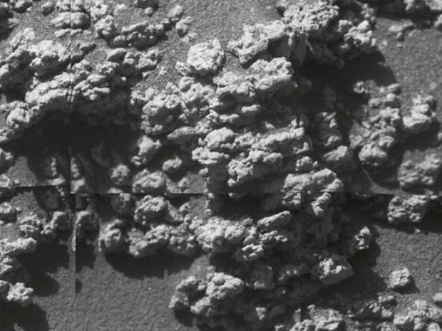
NASA/JPL/CORNELL
After months spent crossing a sea of rippled sands, Opportunity reached an outcrop in August 2005 and began investigating exposures of sedimentary rocks, intriguing rind-like features that appear to cap the rocks, and cobbles that dot the Martian surface locally.
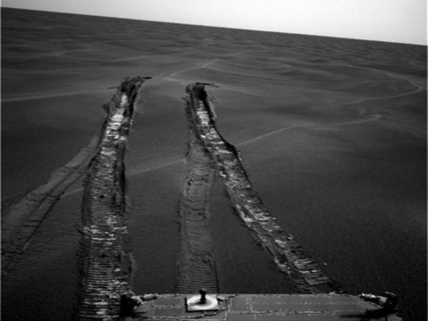
NASA/JPL
The wheels of NASA's Opportunity dug more than 10 centimeters (4 inches) deep into the soft, sandy material of a wind-shaped ripple in Mars' Meridiani Planum region during the rover's 446th Martian day, April 26, 2005. Getting the rover out of the ripple, dubbed "Purgatory Dune," required more than five weeks of planning, testing, and carefully monitored driving.