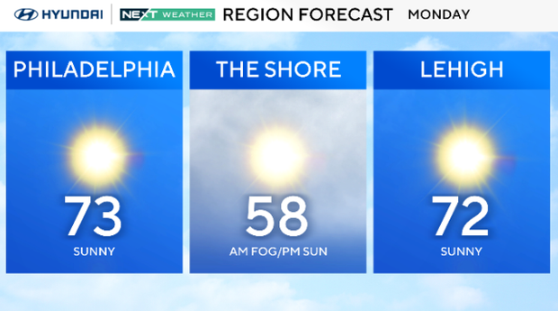
Mostly sunny, very mild Monday in Philadelphia region. Here's the weather forecast.
Monday will be a gorgeous day in the Philadelphia region. Skies will be mostly clear and sunny throughout the day.
Highs will reach the low 70s except along the shore, where temperatures hover in the 50s.
NEXT big weather changes
Tuesday and Wednesday will be warm with highs in the mid to upper 70s.
The old record high on Wednesday is 74, set in 2021, and we will most likely tie or break it.
Tuesday starts with fog and turns sunny, but on Wednesday, clouds will increase ahead of a strong cold front to the west.
By Thursday, a strong cold front crosses the area, and temperatures plummet 20-30 degrees between Wednesday afternoon and Thursday afternoon.

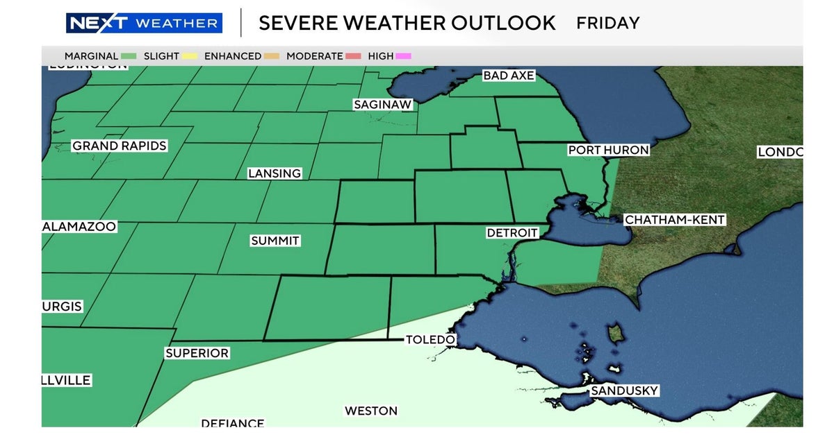
The front will trigger rain and a few rumbles, and we have a Marginal Level 1 risk of severe weather in our farthest western zones.
The cold air arriving with the front may be cold enough for rain changing to a wintry mix for the Poconos, Lehigh Valley and the upper Pennsylvania suburbs.
The shocking drop in temperature continues, with Friday struggling to reach 50.
Here's your 7-day forecast:
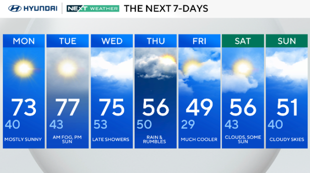
Monday: Mostly sunny. High 73, low 40.
Tuesday: Fog early. High 77, low 43.
Wednesday: Late showers. High 75, low 53.
Thursday: Rain and rumbles. High 56, low 50.
Friday: Much cooler. High 49, low 29.
Saturday: Clouds, some sun. High 56, low 43.
Sunday: Cloudy skies. High 51, low 40.