Mostly sunny, seasonable Tuesday in Philadelphia region before more storms this week. Here's the forecast.
Tuesday brings the nicest weather of the week in the Philadelphia region with seasonable temperatures, tolerable humidity and sunshine.
Make it a point to get outdoors, whether to clean up after the storms or to eat lunch outside, before humidity and storm chances return Wednesday. Tuesday night will be a pleasant evening for the Phillies-Nationals game at Citizens Bank Park.
NEXT big weather changes
A warm front will then lift through the region Tuesday night into Wednesday, bringing another round of showers and thunderstorms.
The storms will be isolated but could produce heavy rain and flash flooding, especially in areas that received significant rainfall.
Slow-moving storms could worsen the flooding threat, while any stronger storms may produce damaging wind gusts.
Once the front moves north, warm and humid conditions will settle in for the second half of the week.
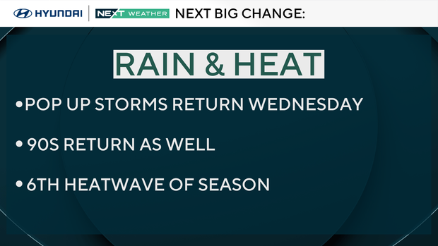
Thursday through the weekend will feature daily chances for scattered showers and thunderstorms, mainly during the afternoon and evening.
It will not rain all day or everywhere each day, but outdoor plans may need some flexibility as the unsettled summer pattern continues. It's looking like a heat wave may begin Thursday, with highs in the low 90s each day through the weekend.
The humidity levels will skyrocket with dewpoint temps in the mid-to-upper 70s for most of the remainder of the week. Get ready to sweat, big time, if you are going to be outdoors.
Here's your 7-day forecast:
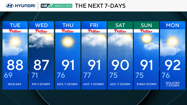
Tuesday: Nice day. High 88, Low 69
Wednesday: P.m. storm. High 87, Low 71
Thursday: Hot, thunderstorm. High 91, Low 76
Friday: Hot, thunderstorm. High 91, Low 77
Saturday: Hot, thunderstorm. High 91, Low 75
Sunday: Stray storm. High 91, Low 75
Monday: Isolated thunderstorms. High 92, Low 76


