Chance of storms Tuesday in Philadelphia region, but relief from heat is on the way. Here's the forecast.

Temperatures look to stay below 90 degrees in the Philadelphia region for your Tuesday, meaning our sixth heat wave will likely come to an end.
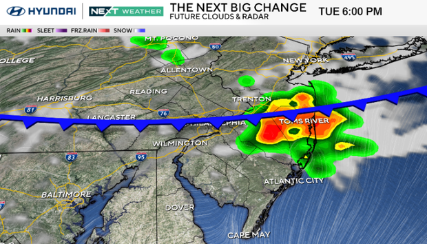
The threat of storms continues Tuesday as a front approaches the Philadelphia area. There could be a morning shower in the western part of the region, but otherwise it will be partly cloudy with plenty of humidity.
Tuesday evening into the overnight hours, we could see scattered showers and thunderstorms, with some storms again capable of becoming strong to severe.
NEXT big weather changes
Heading into Wednesday, Tuesday night's storms will gradually clear out, and humidity will subside a bit.
It'll start to feel a little more comfortable out there. Temperatures should trend closer to the 80s later in the week.
We'll make a run back to near 90 on Thursday, but another cold front sweeps through late, ushering in another push of dry, comfortable air just in time to start the weekend.
Here's your 7-day forecast:
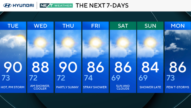
Tuesday: Hot, p.m. storm. High 90, Low 73.
Wednesday: Morning shower, cooler. High 88, Low 72.
Thursday: Partly sunny. High 90, Low 72.
Friday: Stray shower. High 86, Low 74.
Saturday: Sun and clouds. High 86, Low 69.
Sunday: Showers late. High 84, Low 69.
Monday: Few thunderstorms. High 86, Low 73.


