Partly sunny, less humid Saturday in Philadelphia region, tracking rain Sunday. Here's the weather forecast.


Saturday will be the nicer of our two weekend days in the Philadelphia area with lower humidity and highs in the upper 70s.
A mix of clouds and sun will keep the glare down, but you'll need the sunglasses at times.
Saturday night, clouds increase, but we remain dry through midnight. Scattered showers will develop after that.
NEXT big weather change
Umbrella alert for Sunday with several rounds of rain and brief downpours possible. Skies will be cloudy all day, so no need for sunglasses.
Did someone say FALL? It arrives Tuesday morning at 8:04 a.m. and ushers in unsettled and much cooler weather.
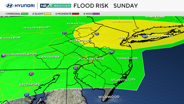
Gone will be the summer heat and bright sunshine. It's not completely unlikely to see the sun this week, but overcast skies will be more common.
There is also a chance of showers each day Monday-Friday as a frontal boundary and several disturbances will hover nearby.
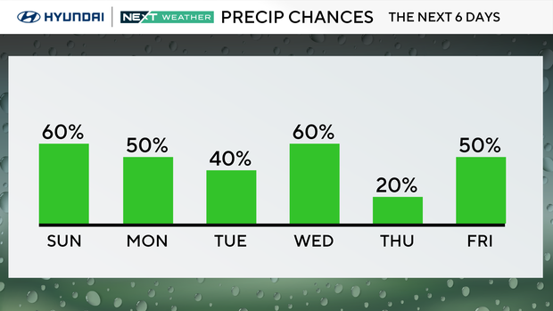
The real question is, will you be able to break out the Autumn sweater and boots? The answer is yes! Temperatures will run 10-15 degrees below average in the mid-60s each day. Perfect for some cozy clothes.
If you want more summer days, you're out of luck. Starting Tuesday you'll have to wait 275 days for the start of summer 2027 which is on June 21, 2027.
Philadelphia Eagles forecast in Nashville, Tennessee

The birds head to Nashville where summer heat and humidity will be in full swing.
At kick off, temperatures will be in the upper 90s with higher humidity and a feels-like near 100 degrees.
Winds will be from the west, and skies will be partly cloudy.
Here's your 7-day forecast:
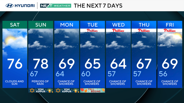
Saturday: Sun and clouds. High 76, Low 64
Sunday: Rain arrives. High 78, Low 67
Monday: Chance of showers. High 69, Low 64
Tuesday: Chance of showers. High 65, Low 63
Wednesday: Chance of showers. High 64, Low 57
Thursday: Chance of showers. High 67, Low 57
Friday: Chance of showers. High 69, Low 56
Get the latest weather info on the CBS News Philadelphia app.


