Warm, sunny Wednesday in Philly area before rain arrives later this week
You'll want a light jacket heading out the door, and watch for some patchy fog during the morning commute on Wednesday in the Philadelphia region.
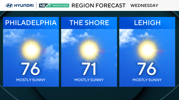
Once the fog clears, break out the sunglasses! With afternoon temperatures climbing into the mid-70s, nearly 15 degrees above average, it's another great day to grab lunch outside, take a walk or tackle some yard work.
Leave the umbrella at home, but don't put it too far away. Our dry stretch is about to end!
NEXT big weather changes
Thursday marks the beginning of a significant pattern change across the Delaware Valley.
Clouds increase as a cold front approaches, bringing the chance for showers throughout the day. Despite the clouds, temperatures remain unusually warm, reaching the lower 70s (normal high temp is 60).
The bigger weather story develops Thursday night into Friday as a more widespread area of rain moves across the region.
Friday looks particularly wet, with periods of heavy rain and even a few thunderstorms possible.
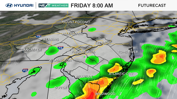
Rainfall totals of 1 to 2 inches are possible in parts of the area, raising concerns for ponding on roads and localized flooding. This could make Friday morning's commute slow and messy, especially east of the Philly area all the way to the shore.
The good news? The rain moves out in time for the weekend!
Sunshine returns Saturday, with temperatures falling into the 60s.
By Sunday, we'll finally feel more like November, with highs around 60 degrees and chilly overnight temperatures dipping into the 40s.
The unusual warmth is coming to an end, at least for now.
Here's your 7-day forecast:
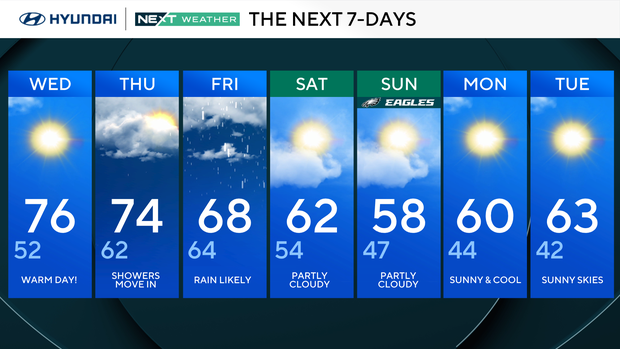
Wednesday: Warm day. High 76, Low 52
Thursday: Showers move in. High 74, Low 62
Friday: Rain likely. High 68, Low 64
Saturday: Partly cloudy. High 62, Low 54
Sunday: Partly cloudy. High 58, Low 47
Monday: Sunny and cool. High 60, Low 44
Tuesday: Sunny skies. High 63, Low 42
Get the latest weather info on the CBS News Philadelphia app.


