Colder Thursday in Philadelphia region, mild and sunny for Valentine's Day. Here's the weather forecast.
After a taste of more seasonable conditions yesterday with highs in the middle 40s, cooler air sneaks back into the Philadelphia region Thursday.
Clouds stream in from the northwest behind a disturbance that moved through overnight. Temperatures will be nearly 10 degrees cooler today, but still above freezing in the mid 30s.
Breezy northwest winds will occasionally gust to 25 mph and wind chills will hover in the 20s.
Overnight, it will be less breezy with temperatures dropping to the low and mid-20s under partly cloudy skies.
NEXT big weather changes
The first big change arrives on Valentine's weekend. Saturday will be nice with highs in the upper 40s and partly to mostly sunny skies.
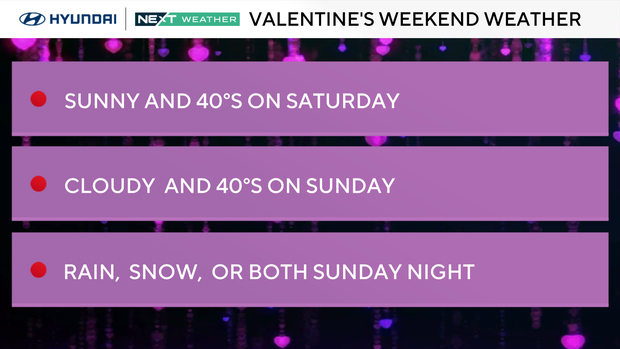
On Sunday, clouds increase as a coastal storm passes by to our south. Daytime highs in the 40s will tumble to near freezing overnight. The models continue to bounce back and forth with chances of rain, snow, both, or nothing. The track is key, and any precipitation will be late in the day Sunday through the overnight.
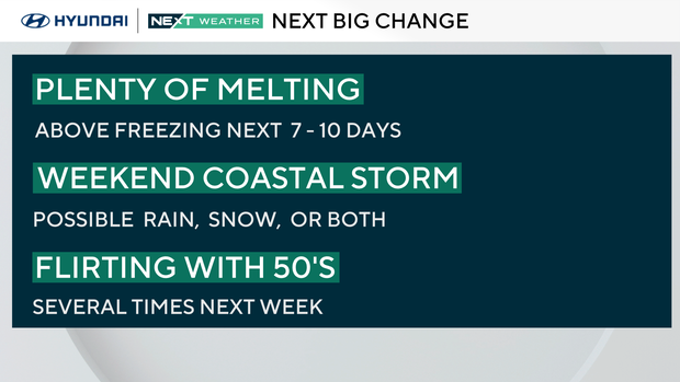
That said, even if there is snow, it will melt quickly since the coldest time will be Sunday evening and overnight, followed by a warm-up to the mid and upper 40s on Monday. There's simply no Arctic air in place to keep things frozen.
The second big change is that our upward temperatures trek into the low 50s on Tuesday. The extended outlook keeps us above freezing during the day for the next 7-10 days.
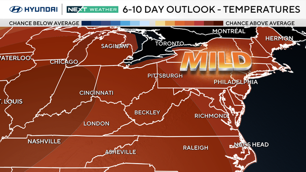
Beginning this weekend, we will be back above our normal daytime high in the low 40s through all next week.
Here's your 7-day forecast:
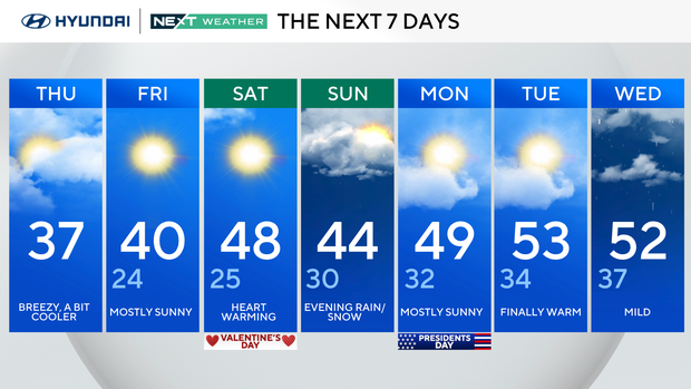
Thursday: Breezy and a bit cooler. High 37.
Friday: Mostly sunny. High 40, low 24.
Saturday: Heart-warming (Valentine's Day). High 48, low 25.
Sunday: Evening rain or snow. High 44, low 30.
Monday: Mostly sunny. High 49, low 32.
Tuesday: Finally warm. High 53, Low 34.
Wednesday: Mild. High 52, low 37.