High temperatures reach upper 30s in Philadelphia today, more Arctic air in weekend forecast
The run of subfreezing temperatures has come to an end, but it brings with it an increased risk of thaw and refreeze.
Temps the next few days should have highs above freezing, but will likely stay below our normal high of 42 degrees. Morning lows will be in the teens with windchills in the single digits, but a slow warming trend is on the way for now.
We are back on a NEXT Weather alert this weekend for another Arctic blast.
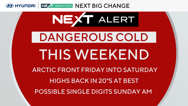
A clipper passes by well south tonight, and we've removed the mention of snow from most forecast areas overnight. Parts of Delaware could see a snow shower, but expect quiet conditions for Wednesday and Thursday, followed by an Arctic cold front with snow showers and squalls likely late Friday. After that, the bottom falls out once again.
NEXT weather change
Temps will plunge Friday night and windchills will struggle to get above zero most of the weekend. Winds themselves will likely gust to 30 mph, the strongest Saturday during the day, with air temps staying in the teens. Then Sunday, windchills will stay below 10 degrees, even during peak heating of the day.
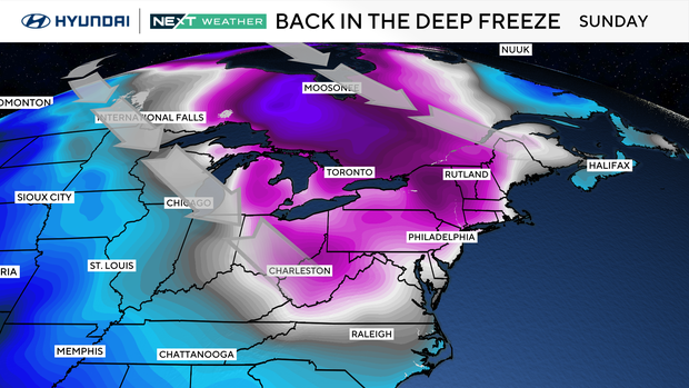
Our forecast low of 7 Sunday morning would be the coldest temp of winter, if we drop that far. If the winds stay up, we may not, but regardless, it will feel like below-zero cold. The record low for Sunday is -2 degrees, so no records will be set.
Here's your 7-day forecast:
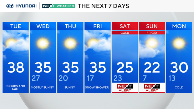
Tuesday: Clouds and sun. High 38.
Wednesday: Mostly sunny. High 35, low 27.
Thursday: Sunny. High 35, low 20.
Friday: Snow shower. High 35, low 17.
Saturday: NEXT Weather Alert. High 25, low 23.
Sunday: NEXT Weather Alert. High 22, low 7.
Monday: NEXT Weather Alert. High 30, low 13.