Wet weather this week with a warmup in store for the Philadelphia area. Here's the forecast.
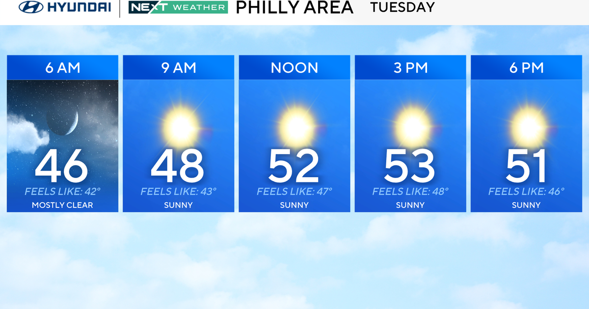
After a messy morning, the freezing rain threat in Philadelphia has ended, with temperatures now above freezing. Still, we'll have cold, cloudy and rainy conditions all day with steadier rain likely in the evening.
You'll want your coat and umbrella Tuesday.
A winter weather advisory is in effect until 11 a.m. in Bucks, Chester and Montgomery counties. This alert will continue in the Lehigh Valley from now until 1 p.m.
Slick conditions will last longest in areas far northwest of Philadelphia, where temperatures hang out near freezing all day.
NEXT big weather changes
By Wednesday, we flip the script and turn more spring-like with highs in the 50s. We'll have rain chances through the end of the workweek as well. Wednesday starts dry before moisture looks to move in Wednesday night.
Thursday through the weekend, we'll see a temperature transition around the region.
Saturday, there may even be a few 70s south of the city, and by Sunday, the 70s will be widespread across the area.
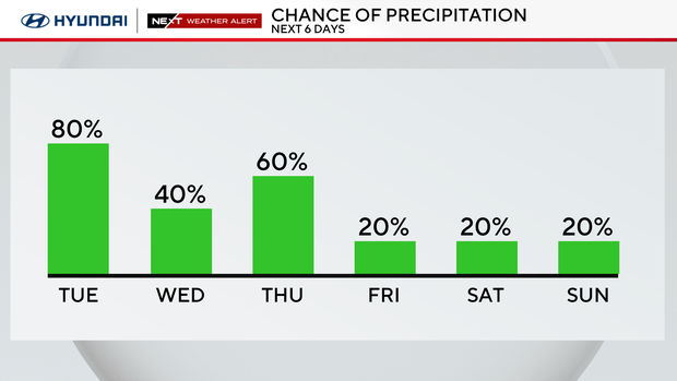
Expect a wetter pattern to arrive as well. Most days have at least a chance of showers.
Here's your 7-day forecast:
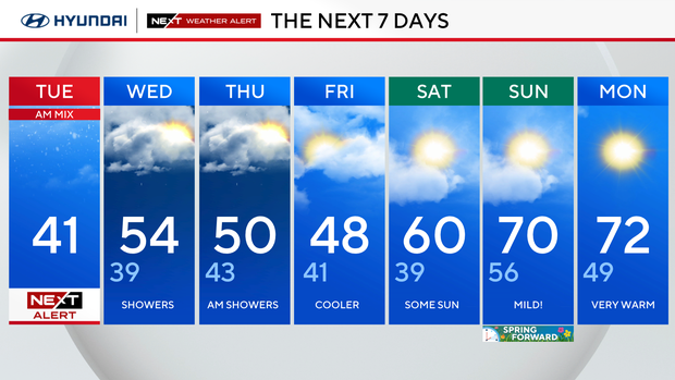
Tuesday: NEXT Weather Alert for early mix. High 41
Wednesday: Morning showers. High 54, low 39.
Thursday: Clouds and showers. High 50, low 43.
Friday: Mostly cloudy. High 48, low 41.
Saturday: Mild. High 60, low 39.
Sunday: A run at 70. High 70, low 56.
Monday: Mostly cloudy. High 72. Low 49.