Cloudy and cool Sunday in Philadelphia, rainy but warmer weather pattern arrives midweek
Welcome to meteorological spring! An Arctic front will cross the area today generating scattered sprinkles and wintry mix. Skies will be mainly cloudy for much of the day with some late afternoon sun.
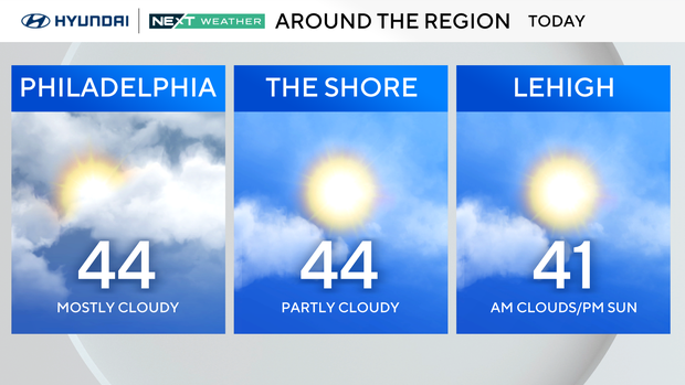
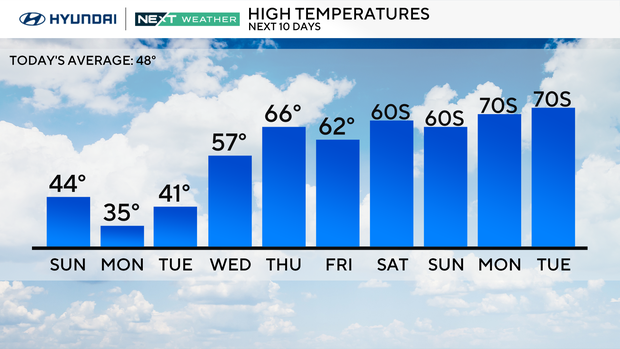
Behind the front, bitterly cold Arctic air filters back into the area. High temperatures Sunday will run below average in the low-to-mid-40s That is also 15-20 degrees colder than yesterday's high of 60.
Temperatures will fall quickly at night to the teens and low 20s under clear skies.
On Monday you'll want to dress for winter since temperatures will hover near freezing under sunny to partly cloudy skies. But there's good news if you're tired of the cold – this may be the last of the Arctic cold now that spring is knocking at the door!
NEXT big weather change
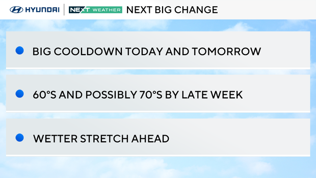
Looking ahead to the week, it's all about the huge temperature swing.
Monday will be brutally cold with morning lows in the teens and low 20s. Daytime highs will only reach the upper 20s to low 30s despite bright sunshine.
Tuesday will also be cold with 20s and a wintry mix in the morning and low 40s with rain showers in the afternoon. But by Wednesday, we flip the script and turn more spring-like with highs in the 50s.
Thursday through the weekend is even warmer as we chase the 60s for the first time since Dec. 19. On Saturday, a few spots south of the city may even reach 70 degrees.
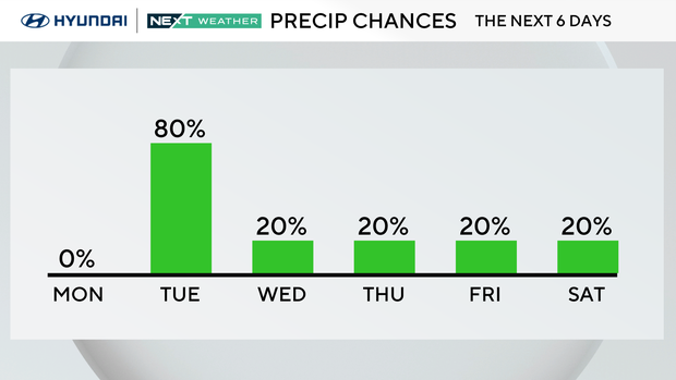
But with the warmth comes a wetter pattern as well. Every day this week except Monday there's a chance of a brief wintry mix or rain showers, so carry the umbrella.
Here's your 7 day forecast:
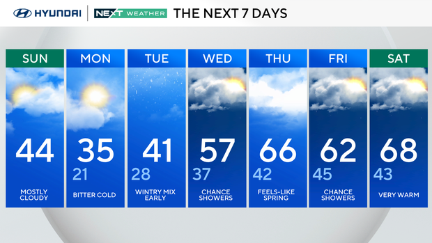
Sunday: Showers, a mix? High 41, Low 37
Monday: Mostly sunny, cold. High 37, Low 20
Tuesday: Rain and mix. High 42, Low 27
Wednesday: Mainly cloudy. High 55, Low 37
Thursday: Some sun. High 60, Low 40
Friday: More clouds than sun. High 62, Low 46
Saturday: More clouds than sun. High 70, Low 48