Philadelphia Weather: Severe Storms To Bring Possible Isolated Tornadoes, Damaging Wind Gusts To Parts Of Region
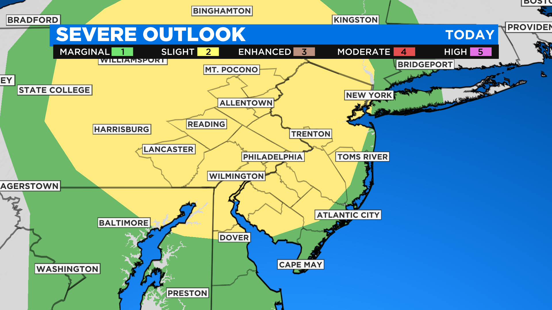
PHILADELPHIA (CBS) -- Saturday will be another unseasonably warm day under mostly cloudy skies but atmospheric conditions have shifted in the past 24 hours with an upgraded risk for severe storms and a threat for damaging winds and isolated tornadoes late today and this evening.
Skies are partly sunny today allowing for temperatures to rise quickly to the low and mid-70s. Across parts of Delaware highs will edge toward the 80ss. Humidity will also be on the rise with dew points in the low 60s.
By early afternoon winds will increase from the southwest ahead of a cold front approaching from central Pennsylvania where storms will already be ongoing. The wind speeds will increase at the higher levels of the atmosphere, creating spin.
By late afternoon, the atmosphere will become very unstable and favorable for severe storms.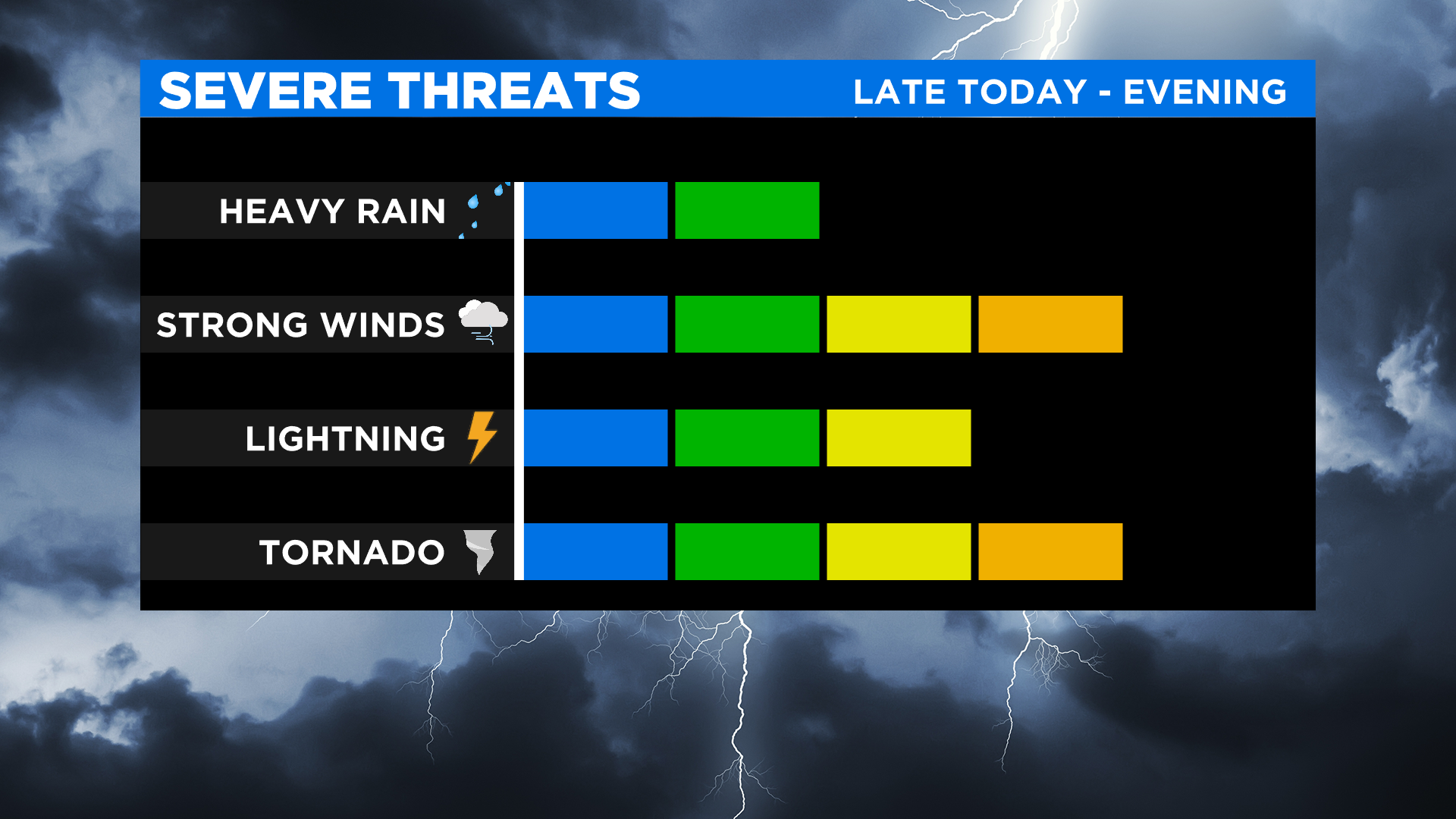
Between 5 - 7 p.m. we will see scattered storms develop in the Lehigh Valley. Any of these storms could turn severe and develop into individual supercell storms, which can produce tornadoes.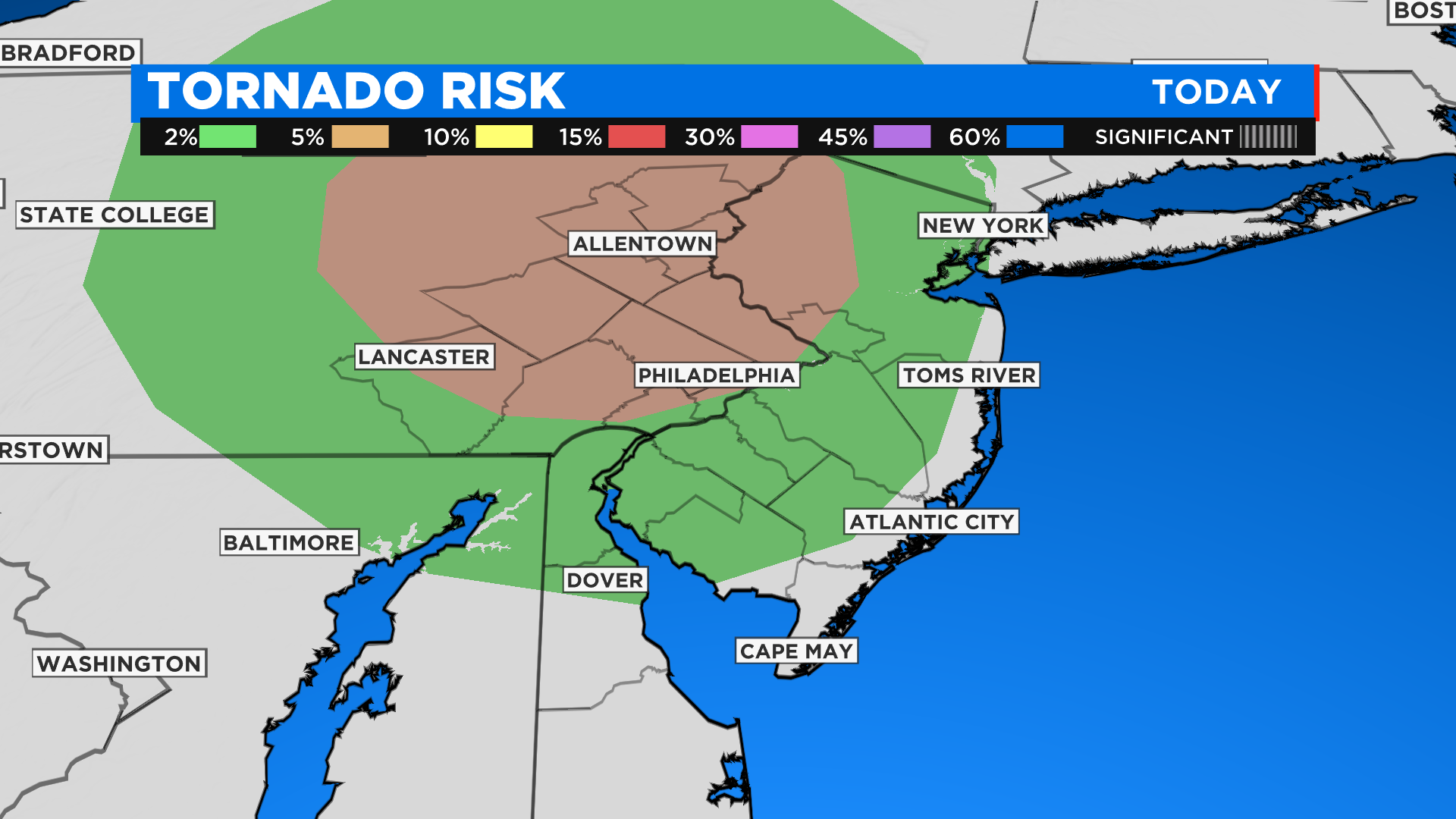
The threat of isolated tornadoes and damaging winds will continue into the evening as the storms track east reaching Philadelphia and the I-95 corridor between 7 - 9 p.m. and South Jersey between 9 - 10 p.m. The storms will weaken as they cross South Jersey and mainly showers are expected down the Shore with an isolated storm possible.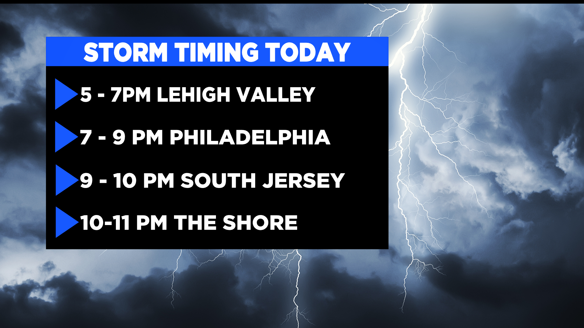
Now that our spring severe weather season has begun this is a good time to create a personal and family safety plan to follow if severe weather strikes where you live. Don't forget to download the free CBS Philly Weather app to follow the radar and get instant storm warnings and updates.