Humidity drops in Philadelphia region with temps in 80s, tracking Sunday rain. Here's the weather forecast.
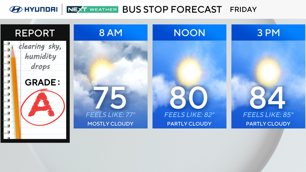
We're ending the workweek on a really nice note. It still feels pretty muggy after dewpoints started the morning around 70. But drier air is already beginning to work into the region, and you'll notice the difference as we head through the afternoon.
Clouds gradually break for more sunshine with highs reaching the low to mid 80s. More importantly, humidity continues dropping, so the afternoon should feel considerably more comfortable than the morning.
For outdoor plans, this is a sunglasses over umbrella kind of day. Any leftover spotty shower threat is fading quickly, and the afternoon and evening look dry. It's a great day for lunch outside, tennis, a walk or even one of those increasingly precious late-season pool afternoons.
If you're heading to the shore, expect a mix of clouds and sun with improving humidity there as well. Tonight is comfortable for Friday night plans with temperatures falling through the 70s.
NEXT big weather changes
Saturday is definitely the pick of the weekend. A cooler, drier air mass settles in with partly sunny skies, comfortable humidity and highs only in the mid to upper 70s. If you have outdoor plans this weekend, Saturday is the day to prioritize them.
The pattern changes Saturday night as moisture begins returning ahead of our next system. Clouds thicken overnight with a few showers possible toward daybreak Sunday.
Sunday turns much more humid and increasingly wet, especially during the afternoon and evening. Periods of rain and a few thunderstorms are likely, and some downpours could be locally heavy. Right now, the heavier rain threat appears somewhat greater north and west of Philadelphia, but localized flooding will be possible anywhere repeated downpours develop.
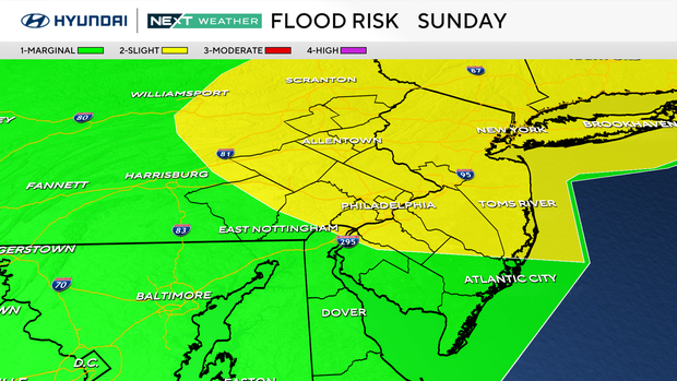
This does not warrant a Next Weather Alert Day at this point, but Sunday is the day to watch as the rain timing and amounts come into better focus.
The system is slow to completely clear out. Monday stays mostly cloudy and cooler with a lingering shower possible, then an even cooler pattern settles in Tuesday and Wednesday. Highs may struggle to get much beyond the mid to upper 60s by Tuesday, giving us a decidedly fall-like feel right as astronomical fall arrives.
Eagles in Tennessee
Birds fans traveling to Nashville this weekend for the Eagles' game against the Tennessee Titans should be prepared to sweat.
Record-breaking hot and humid weather will continue through the weekend, making for potentially dangerous conditions for both players and fans.
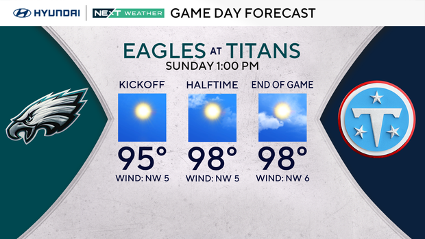
High temperatures Sunday afternoon are forecast to be in the upper 90s, challenging the record high temperature in Nashville of 99 degrees set in 2022.
To make matters worse, the humidity will make it feel like anywhere between 105 and 110 degrees. Wearing lightweight clothing and staying hydrated will be the key to beating the heat (and the Titans) in Nashville this weekend.
Here's your 7-day forecast:
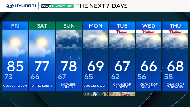
Friday: Clouds to sun. High 85, Low 73
Saturday: Partly sunny. High 77, Low 66
Sunday: Showers likely. High 78, Low 67
Monday: Cool, showers. High 69, Low 65
Tuesday: Chance of showers. High 67, Low 62
Wednesday: Chance of showers. High 66, Low 56
Thursday: Chance of showers. High 68, Low 58
Get the latest weather info on the CBS News Philadelphia app.


