Philadelphia region under severe thunderstorm watch through Friday evening
A line of strong to severe thunderstorms is forecast to sweep through the Philadelphia region and Jersey Shore communities Friday evening before some of the coldest air of the fall season settles across our area.
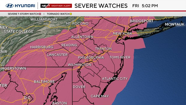
The Storm Prediction Center issued a severe thunderstorm watch until 8 p.m. for all of eastern Pennsylvania, including Philadelphia. A second watch runs through 10 p.m. for Delaware and New Jersey.
Damaging wind gusts up to 70 mph are likely, and a few tornadoes are possible, especially across parts of Pennsylvania, according to the Storm Prediction Center.
The region started the morning with clouds, areas of drizzle and temperatures around 60 degrees, but conditions improved temporarily as a warm front lifted north.
Some afternoon sunshine helped temperatures climb into the upper 70s to around 80, while southwest winds brought increasingly humid air into the region. Dewpoints climbed into the 60s, giving us one last summerlike afternoon before the dramatic change arrives Friday night.
Keep the umbrella handy and pay attention to the forecast if you have evening plans.
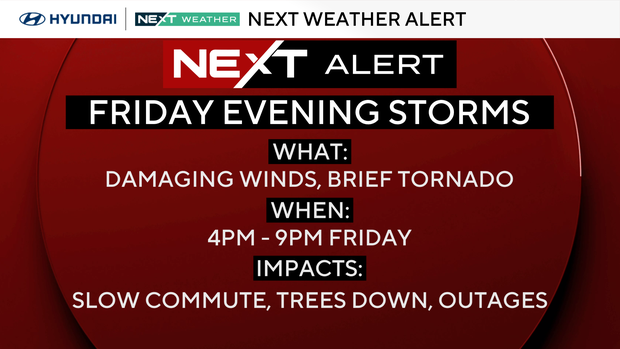
The greatest severe weather concern is through about 10 p.m. when a line or broken line of thunderstorms moves through the region. Damaging wind gusts are our primary concern, although an isolated tornado cannot be ruled out.
Not everyone will experience severe weather, but storms could affect the evening commute, high school football games and other outdoor activities. At the shore, conditions will become increasingly windy, with rough seas developing Friday night into Saturday.
Our biggest concern Friday is the approaching cold front and the potential for severe thunderstorms.
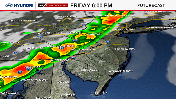
A powerful upper-level trough is moving into the Northeast, accompanied by a strengthening area of low pressure to our north. Strong winds throughout the atmosphere will create significant wind shear, while the return of warmer, more humid air provides the instability needed for thunderstorms.
The region remains under a slight risk — level 2 of 5 — for severe weather, with damaging straight-line winds the most likely hazard and a low-end tornado threat also present. Any stronger storms could bring down trees or power lines, and even locations that miss the worst thunderstorms will notice increasing winds as the front approaches. The threat should gradually diminish later tonight as the front moves offshore.
NEXT big weather changes
Behind the front, we're looking at a dramatic return to chilly October weather.
Temperatures will fall into the 40s overnight, and Saturday's high will only reach the mid-50s, more than 20 degrees colder than Friday.
Sunshine returns, but gusty northwest winds of 25-plus mph will make it feel even colder, particularly during the morning and early afternoon. Saturday looks dry for fall festivals, outdoor sports and other weekend plans, but you'll definitely want a jacket.
At the shore, strong winds and hazardous marine conditions will continue through much of the day.
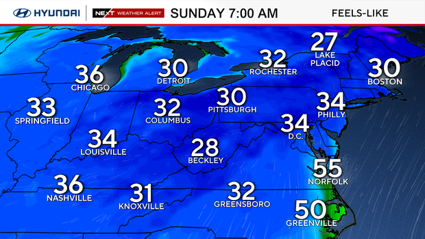
Sunday morning is also a NEXT Weather Alert day due to the potential for frost and freezing temperatures.
A freeze watch is in effect from 1 a.m. to 9 a.m. Sunday.
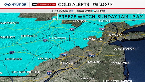
As high pressure builds in and winds relax Saturday night, temperatures could fall into the lower to mid 30s across some of our colder northern and western suburbs. Philadelphia should stay closer to the upper 30s, but sensitive plants in outlying areas may need protection.
Sunday afternoon looks beautiful, with sunshine, lighter winds, and highs near 60 degrees. That's also good news for the Eagles game, with dry and comfortable fall weather expected.
The colder weather won't last too long.
Temperatures will gradually moderate next week, reaching the mid-60s on Monday and around 70 degrees on Tuesday, with generally dry conditions continuing.
Here's your 7-day forecast:
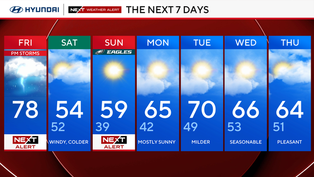
Friday: NEXT Weather Alert. High 78, Low 61
Saturday: Windy, colder. High 54, Low 52
Sunday: NEXT Weather Alert. High 59, Low 39
Monday: Mostly sunny. High 65, Low 42
Tuesday: Milder. High 70, Low 49
Wednesday: Seasonable. High 66, Low 53
Thursday: Pleasant. High 64, Low 51
Get the latest weather info on the CBS News Philadelphia app.


