Severe thunderstorm watch in effect for Philadelphia region Sunday night on final day of heat wave


Severe storms are a big concern for the Philadelphia region Sunday evening and overnight.
A severe thunderstorm watch has been issued for the Philadelphia region through 1 a.m. Monday.
A flash flood warning is in effect until 11:30 p.m. in Burlington and Mercer counties in New Jersey as well as Bucks, Montgomery and Philadelphia counties in Pennsylvania.
A severe thunderstorm warning is in effect in Berks, Chester and Montgomery counties until 10:15 p.m.
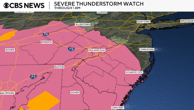
The atmosphere will be very unstable with the heat and humidity driving the storms. Almost every storm that develops will turn severe, just like the last three evenings.
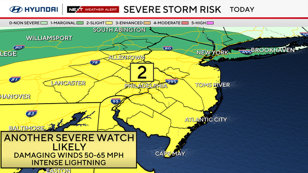
Expect damaging wind gusts over 60 mph and intense lightning. Small hail is also possible. Watch for power outages, travel delays, downed trees and utility lines.
However, the biggest threat will be the tropical downpours and flash flooding. A flood watch is in effect through Monday evening as some areas could get 2+ inches of rain.
Sunday was the final day of a seven-day heat wave in the Philly area.
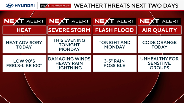
NEXT big change
Monday will be much cooler than average with highs only in the upper 70s, but there is a significant chance of heavy rain and flash flooding.
Several waves of storms with tropical downpours will cross the area and some of us will see and additional 2-4" of rain for a grand total of 3-5" between Sunday evening and Monday night.
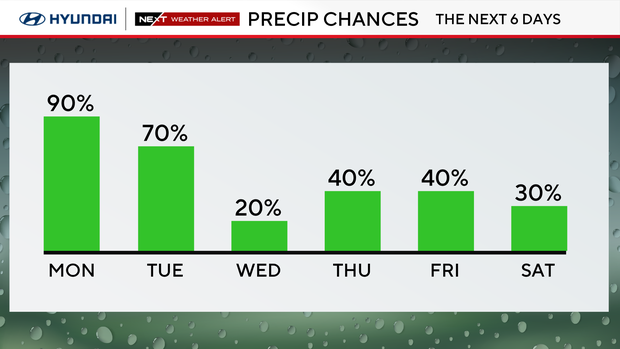
A flood watch is in effect from Sunday evening through Monday evening.
Streets could flood, so remember, "turn around, don't drown." Less than 2 feet of water can float your car and carry it away. Power outages are also possible tonight.
Here's your 7-day forecast:
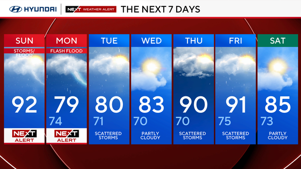
Sunday: NEXT Weather Alert. High 92.
Monday: NEXT Weather Alert. High 79, low 74.
Tuesday: Scattered storms. High 80, low 71.
Wednesday: Partly cloudy. High 83, low 70.
Thursday: Scattered storms. High 90, low 70.
Friday: Scattered storms. High 91, low 75.
Saturday: Partly cloudy. High 85, low 73.