Sunny and chilly Sunday in Philadelphia area, freeze possible in some areas. Here's the weather forecast.

Sunday starts cold with temperatures in the 30s and some spots at or below freezing north and west of Philadelphia.
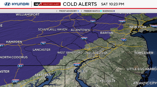
A freeze alert is in effect from 1 a.m. to 9 a.m. Sunday for Upper Bucks, Upper Montgomery, Upper Chester and Berks counties as well as the Lehigh Valley and the Poconos. Frost is possible in other parts of the region.
On Sunday, we'll have plenty of sunshine, but you'll still want a jacket with afternoon highs only reaching the 50s. Another round of frost is possible Sunday night into Monday morning, especially in the Lehigh Valley, Poconos and northern New Jersey.
NEXT big change
Monday starts off chilly, with patchy frost possible north and west of Philly, followed by some sunshine as temperatures begin to inch back up.
We'll gradually shake off some of the weekend chill early in the week, though the forecast becomes less certain by Wednesday and beyond.
Around Philly and farther inland, significant impacts from the coastal storm look less likely, but we could still see some clouds, a breeze and a few showers depending on how close it gets. At the shore, we're watching for periods of gusty northeast winds, showers and possible coastal flooding that could linger for several days.
Here's your 7-day forecast:
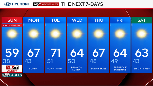
Sunday: NEXT Weather Alert for frost/freeze. High 59, Low 38
Monday: Sunny. High 67, Low 43
Tuesday: Sunny skies. High 71, Low 51
Wednesday: Bright and sunny. High 64, Low 50
Thursday: Sunny skies. High 67, Low 48
Friday: Plenty of sunshine. High 64, Low 49
Saturday: Bright skies. High 63, Low 43
Get the latest weather info on the CBS News Philadelphia app.


