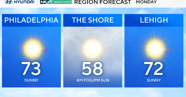
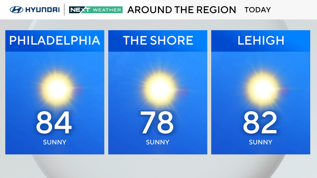
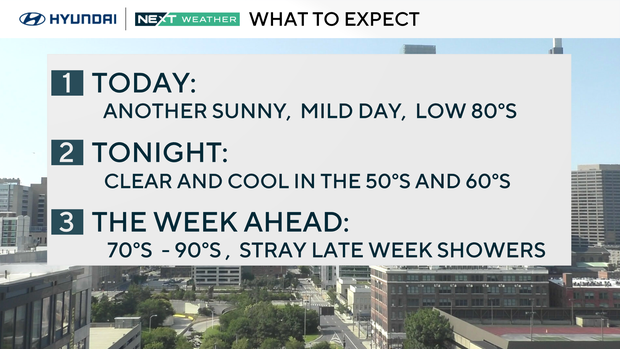
Another sunny, mild day with low humidity in the Philadelphia area. Here's the forecast.
After our almost fall-like morning lows in the 50s and 60s, we warm to the low 80s on Sunday.
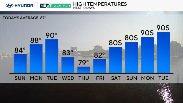
Sunday will be sunny and pleasant with the same low humidity we've seen since the beginning of the weekend. The high temperature sits around 84 degrees, before cooling down at night to a low of 64. Sunday night skies will be clear.
Also, there is a moderate rip current risk down at the Jersey Shore and a high rip current risk at the Delaware beaches. Learn what signs to look out for if you venture into the water and how to stay safe this summer.
This spectacular weather rolls into Monday with sunshine and temperatures in the upper 80s.
Warming up again, chasing 90s
By Tuesday, we will be pushing 90 degrees in Philadelphia with partly cloudy skies and just a tiny bump in humidity.
On Wednesday, high pressure remains to our north, but clouds will increase due to a system suppressed south of us.
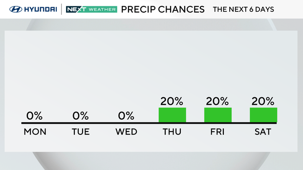
Stray showers are possible Thursday through Saturday, as moisture filters north into the area. The chance of stray showers is mainly south and east of the city.
Temperatures will see-saw a bit as they tumble to the upper 70s and low 80s Thursday, and then climb back to the upper 80s by next weekend.
NEXT Weather calendar lookahead
- Meteorological summer ends in 29 days on Sept. 1.
- Astronomical summer ends and fall begins in 51 days on Sept. 22.
- Labor Day is only 29 days away on Monday, Sept 1.
- Daylight Saving Time ends in 91 days on Sunday, Nov. 2.
Here's your 7-day forecast:
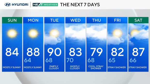
Sunday: Mostly sunny. High 84, Low 64.
Monday: Mostly sunny. High 88, Low 64.
Tuesday: Partly cloudy. High 90, Low 68.
Wednesday: Mostly cloudy. High 83, Low 70.
Thursday: Cool, stray shower. High 79, Low 68.
Friday: Stray shower. High 82, Low 65.
Saturday: Stray shower. High 87, Low 66.