Maps, satellite images show 2023 Canadian wildfire smoke enveloping parts of U.S. with unhealthy air
Smoke from Canadian wildfires caused decreased air quality in the central and northeastern U.S. this week — as seen in maps and satellite images that show the large-scale impact of the blazes.
The National Weather Service said winds were continuing to bring smoke from the fires into the U.S. on Saturday, causing "moderate" to "unhealthy" air quality across the U.S. Northeast, Mid-Atlantic, Ohio Valley and Midwest. For many areas, however, that marked improvements from earlier in the week when they were shrouded in an orange, hazardous haze, leading to flight disruptions and even school cancellations.
There was "widespread improvement" in air quality overnight Thursday into Friday as the thickest wildfire smoke drifted out to the Atlantic, said NOAA's Cooperative Institute for Meteorological Satellite Studies at the University of Wisconsin-Madison.
The weather service said more improvement was expected over the weekend as a low pressure system relaxes and shifts "to more of a westerly direction on Saturday." Weather Channel meteorologist Stephanie Abrams also said relief is on the way, but that hazy skies and reduces visibility will still be seen in the Northeast and Great Lakes Friday.
"This type of pollution is so harmful because the smoke particles are tiny, about 30 times smaller than a strand of human hair, so they can get deep into your body and cause serious health problems," Abrams said.
"Thankfully, this weekend and early next week, a system will come through that's going to give us more of a southerly flow, direct the smoke away from the U.S.," she said.
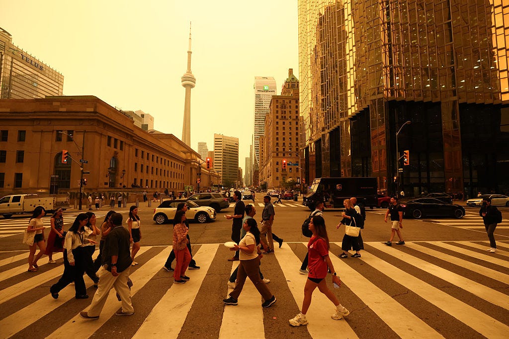
Maps showed skies were clearing over parts of New York City and New York Friday state. However, a health advisory was remaining in effect until midnight, CBS News New York reported. Classes were being held remotely Friday at city schools.
Air quality on Friday was forecast to be "Unhealthy for Sensitive Groups," according to the Air Quality Index, in the Long Island, New York City Metro and Western New York regions, said New York officials. By Saturday morning, the Air Quality Index was showing a "Good" level.
Several maps showed states further west and south, like Pennsylvania and Delaware, seeing worse impacts, although the weather service noted they wouldn't be "as extreme" as in recent days. Much of Pennsylvania and Delaware reported "Moderate" conditions on Saturday morning, according to the Air Quality Index, though air quality in the Liberty-Clairton Area of Pennsylvania was described as "Unhealthy For Sensitive Groups."
Over the past six weeks, hundreds of out-of-control wildfires have spread across Canada, causing mass evacuations and burning through millions of acres. While the Canada wildfire season runs from May through October, such destruction this early in the season is rare. One month in, Canada is on track to have its most destructive wildfire season in history. Climate change-driven extreme temperatures and drought have created a tinderbox.
The National Weather Service has advised people in the U.S. to monitor their local air quality forecasts before spending time outdoors.
"Poor air quality can be hazardous," NWS tweeted earlier this week. "Before spending time outdoors, check the air quality forecast. Make sure you aren't doing yourself more harm than good."
Cara Korte contributed to this article.