South Florida sees enhanced wildfire risk due to dry conditions as warmer temps get set to move in

It was a cool start to the new workweek in South Florida with temperatures in the 50s in Broward and Miami-Dade counties while the Florida Keys woke up to temperatures in the low 60s.
Patchy dense fog was also possible for the inland areas.
There was also the potential for some smoke due to a wildfire that had been burning in far western Broward County. This fire was called the "Buggy Fire" and was located near the Holey Land Wildlife Management area.
It burned about 4,267 acres and is fully contained.
Poor visibility was possible along Alligator Alley between mile markers 32 and 35.
The wind was calm or light on Monday morning, but the breeze started building out of the east throughout the day and that helped to steer any smoke towards the west and the Everglades.
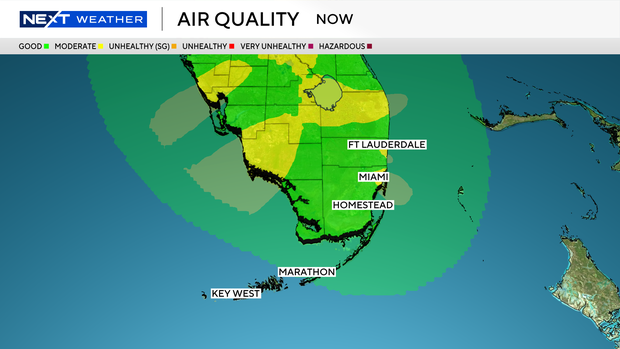
Air quality is good for most of South Florida except for a few areas with moderate air quality close to the coast in Broward and Miami-Dade counties.
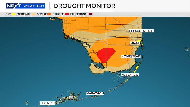
But there is an enhanced fire risk due to very dry conditions.
There is currently a moderate drought for most of Broward and Miami-Dade with some inland areas experiencing a severe drought.
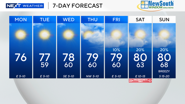
Today will be dry and mostly sunny with highs in the low to mid 70s. There is a dangerous high risk of rip currents along the Atlantic beaches. There are no alerts or advisories for boaters over the Atlantic and Keys waters.
Tuesday morning will be cool again with lows in the upper 50s. Highs will be milder in the upper 70s.
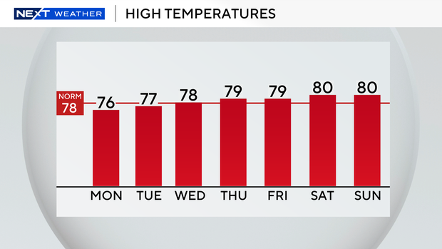
We are in for a warming trend the rest of the week as temperatures will increase a bit.
Mid to late week the forecast lows will be near 60 degrees and highs will climb to near 80 degrees.
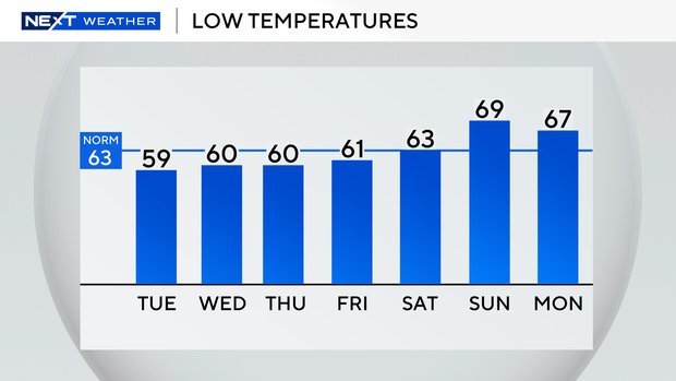
This weekend we'll be even warmer with low 60s and highs will warm to around 80 degrees for Valentine's day on Saturday with the potential for spotty showers through Sunday.