After a cool, sunny Sunday, South Florida faces days of heavy rain and potential flooding

South Florida residents are experiencing a beautiful Sunday, with cool morning temperatures giving way to sunny skies and highs in the low 80s, but a significant change in the weather pattern could bring several days of heavy rain and potential flash flooding beginning Tuesday.
Sunday morning started even cooler than Saturday, with temperatures running about 2 to 3 degrees lower across much of the region.
Temperatures dipped into the upper 50s in several inland communities, including Weston at 57 degrees, Deerfield Beach and Miramar at 59 degrees, and Florida City at 58 degrees. Miami Beach registered 61 degrees, while the Florida Keys remained milder, with temperatures in the mid- to upper 60s.
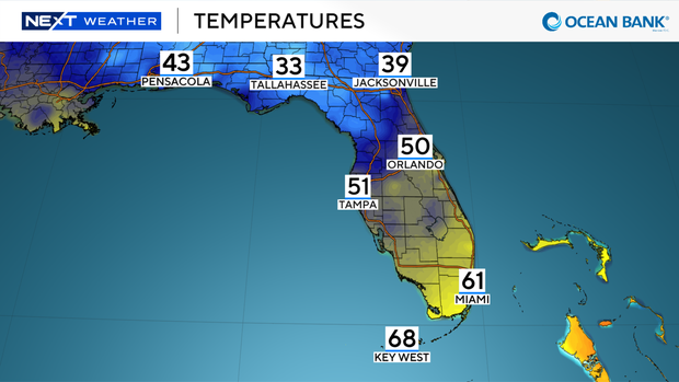
Despite the chilly start, temperatures are expected to climb steadily throughout the day, reaching the 70s by midmorning and the low 80s during the afternoon. The Keys will remain slightly cooler, with highs in the upper 70s.
Sunday's forecast calls for abundant sunshine and virtually no chance of rain, making it an ideal day for outdoor activities before conditions deteriorate later in the week.
When will rain return to South Florida?
Monday will bring another opportunity to enjoy pleasant weather, with sunshine giving way to increasing clouds and afternoon temperatures reaching the low 80s.
However, a developing area of low pressure is expected to change the region's weather pattern beginning Tuesday.
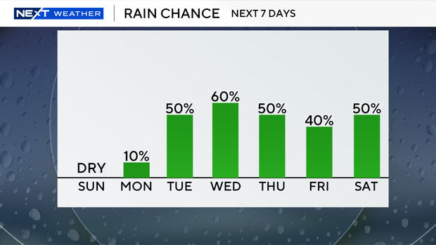
The system will send moisture toward South Florida, setting the stage for an extended period of wet weather that could last through Saturday.
Rain chances are expected to remain elevated from Tuesday through the end of the workweek and into the weekend.
The prolonged stretch of rainy conditions could also bring the potential for flash flooding later in the week, particularly if heavy downpours repeatedly affect the same areas.
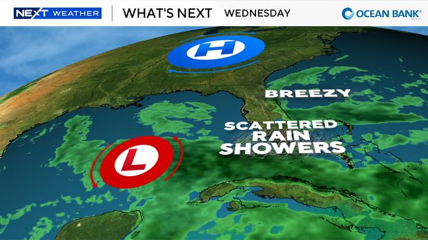
While the exact timing and locations of the heaviest rainfall remain uncertain, residents should prepare for a much wetter pattern after the relatively dry and sunny start to the week.
Will temperatures stay cool in South Florida?
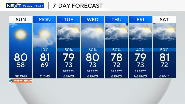
Although Sunday afternoon will be warmer than Saturday, temperatures are expected to remain relatively comfortable throughout the upcoming week.
Highs will generally stay near the low 80s, with temperatures expected to remain below the seasonal average of around 81 degrees for much of the week.
The forecast does not indicate a return to the mid- to upper 80s that South Florida experienced before the recent cool-down.
What are the beach and boating conditions Sunday?
Beachgoers should be aware of a moderate rip current risk along South Florida's Atlantic beaches Sunday.
Rip currents can pose a danger even when skies are sunny and conditions appear calm. Swimmers are encouraged to stay near lifeguards and pay attention to posted beach warnings.
Boating conditions, meanwhile, are expected to be favorable Sunday, with no significant weather-related concerns in the forecast.
Residents looking to spend time outdoors may want to take advantage of Sunday's sunshine and Monday's relatively pleasant conditions before the extended stretch of rainy weather arrives Tuesday.