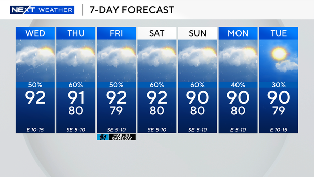
Another round of storms possible in South Florida after rainy start to Wednesday

Keep the rain gear close! Scattered showers and thunderstorms popped up and moved across parts of South Florida on Wednesday morning.
An east breeze will continue to build on Wednesday, and that will help to steer the bulk of thunderstorms towards the interior and Gulf coast during the afternoon hours.
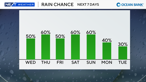
However, later Wednesday night we can expect another round of showers and storms along Florida's east coast and in South Florida metro areas.
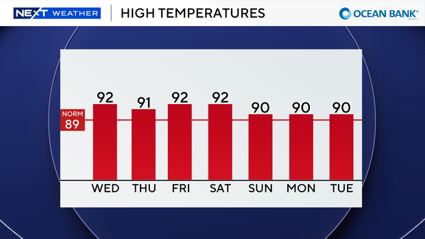
High temperatures will rise into the low 90s on Wednesday afternoon and it will feel like the triple-digits when you factor in the humidity.
The chance of showers and storms will be slightly higher on Thursday.
We'll wake up with another round of wet weather in the morning with scattered storms pushing inland by the afternoon.
Highs will remain seasonably hot in the low 90s.
The rainy season pattern continues through the weekend with daily scattered storms and highs in the low 90s.
It's quiet in the tropics as tropical development is not expected over the next seven days.