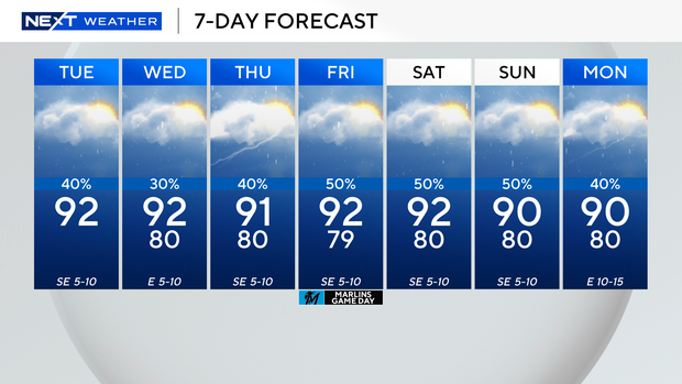
Localized flooding possible in parts of South Florida Tuesday due to rounds of rain, thunderstorms

Keep your umbrellas close by on Tuesday.
Although we enjoyed a mostly sunny start to the day, scattered thunderstorms are expected to develop during the afternoon hours.
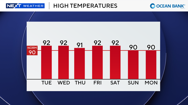
The Weather Prediction Center placed South Florida under a marginal risk of flooding on Tuesday as some thunderstorms that develop could produce heavy downpours and localized street flooding.
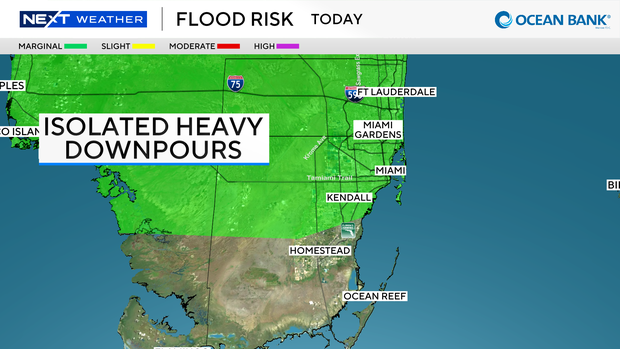
High temperatures are expected to rise into the low 90s on Tuesday afternoon, and it will feel like the upper 90s and 100s.
There is also a low risk of rip currents along our Atlantic beaches. There are no advisories or alerts in effect for boaters over the Atlantic waters or Keys waters.
On Wednesday, the chance of rain will be a bit lower. We will likely still see some wet weather in the morning due to an east breeze moving in.
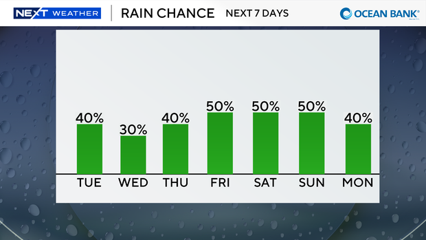
Passing showers and thunderstorms will be possible, but much of the action will be steered towards the inland areas and the west coast in the afternoon.
Later in the week and into the weekend we will settle back into a typical rainy pattern with a 50% chance of seeing scattered showers and thunderstorms every day.
High temperatures will also remain seasonably hot in the low 90s.
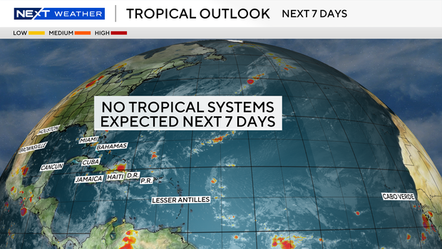
It's quiet in the tropics and tropical cyclone development is not expected in the Atlantic Ocean over the next seven days.