Hot, steamy afternoon ahead across South Florida as weekend rain chances continue to rise

Spotty showers and isolated thunderstorms have been possible across parts of South Florida on Thursday morning.
It's going to be another hot and steamy afternoon ahead for South Florida with high temperatures soaring into the low 90s and "feels-like" temperatures in the 100s when you factor in the humidity.
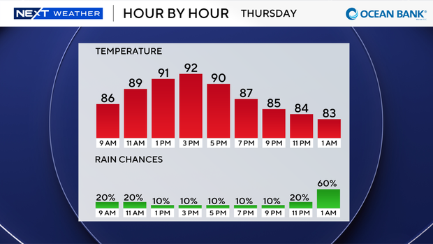
We will enjoy mostly sunny skies with an east breeze at 10-15 mph, with gusts as high as 20 mph.
If you're headed to the beach on Thursday, there is an isolated chance of rip currents.
There are no alerts or advisories in effect for boaters over the Atlantic waters or Keys waters.
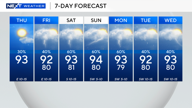
On Friday, the chance of rain will begin to increase with scattered showers and some thunderstorms.
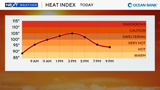
High temperatures will climb into the low 90s, and it will feel like the triple digits.
This weekend will be even wetter due to more moisture on the way associated with a tropical wave. In addition, the wind will shift out of the west and help to steer the more widespread coverage of showers and storms on the east coast metro areas.
It will be even hotter due to the west wind as high temperatures will rise close to the mid-90s.
It will likely feel more humid with heat indices in the 100s due to the tropical moisture around.
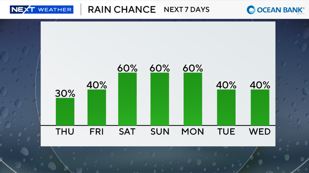
We will remain unsettled through Monday as tropical moisture remains in place, and rain chances stay high.
The CBS News Miami NEXT Weather team is continuing to track Tropical Storm Bertha as it moves westward very near the Louisiana coast.
A tropical storm warning is in effect for the Gulf Coast from the Terrebonne/Lafourche Parish line in Louisiana to Sargent, Texas.
The center of Bertha will move near or along the Louisiana and upper Texas coasts through Thursday afternoon and will then move farther inland into Texas on Thursday evening and night.
Bertha will likely weaken into a tropical depression later on Thursday night or overnight.