Heavy rain, thunderstorms could lead to flash flooding in South Florida later this week

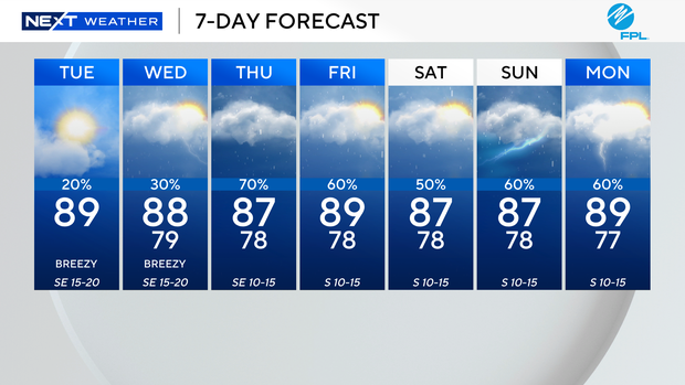
It's going to be warm and breezy in South Florida on Tuesday with spotty showers possible with forecast high temperatures near 90 degrees.

When you factor in the humidity, it will feel like the mid- to upper 90s.
The wind will flow in from the southeast, sustained around 10-20 mph with gusts as high as 25-30 mph.
The CBS News Miami NEXT Weather team is closely monitoring the winds on Tuesday due to the massive junkyard fire in Opa-locka.
The smoke from the fire will lower air quality near Opa-Locka and areas to the west and northwest of the fire.
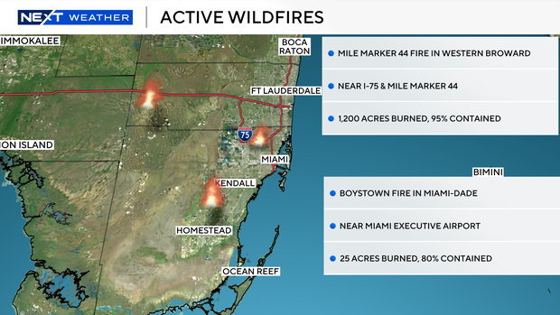
The Mile Marker 44 Fire in western Broward County over the Everglades has burned more than 1,200 acres and is 95% contained. The Boystown Fire in Miami-Dade County near Miami Executive Airport has burned 25 acres and was 80% contained.
The strong onshore wind is leading to a dangerous high risk of rip currents. It's not safe to go swimming in the ocean.
There is a small craft advisory in effect for the Atlantic waters and Keys waters.
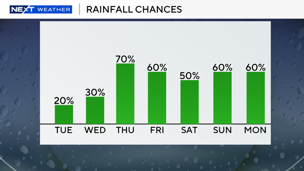
On Wednesday we will stay warm and breezy with passing showers around. The chance of rain increases on Thursday as deep tropical moisture along with an upper level low pressure system will lead to more widespread showers and thunderstorms.
Some heavy downpours and localized flooding will be possible.
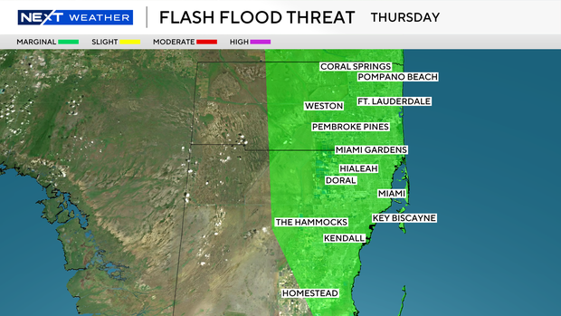
NOAA's Weather Prediction Center has placed South Florida under a Level 1 risk (Marginal Risk) of excessive rainfall due to the potential for flooding on Thursday, Friday and Saturday.
The rain chance stays high Friday and through the weekend.