Rounds of heavy rain lead to flooding in Fort Lauderdale as South Florida braces for more storms

It's been a wet start to the day across parts of South Florida and scattered to numerous storms will be possible throughout the day.
Some of the storms were expected to produce some heavy downpours leading to fears of some localized flooding.
Later on Thursday morning, flooding was reported on some streets in downtown Fort Lauderdale, and some flooding was also reported in Plantation.
Because of the heavy rain, a flood advisory was issued in parts of Broward County on Thursday morning which has since expired. And a flood advisory was issued in Monroe County until later on Thursday afternoon.
Vacuum trucks deployed in Broward for flood mitigation efforts
Several inches of rain fell across parts of Broward on Thursday morning, including in Fort Lauderdale.
And as the rounds of heavy rain continue to pound the region, county officials are working on flood mitigation efforts.
"The County's Highway and Bridge Maintenance Division is actively monitoring the current weather conditions impacting our region," Broward County officials said in a statement.
Officials said that as part of the county's proactive flood mitigation efforts, "all available vacuum trucks have been deployed to clear stormwater systems and manage localized flooding in high-risk areas."
There is also a moderate risk of rip currents along our Atlantic beaches. There are no alerts or advisories for boaters.
Winds will increase out of the east-northeast throughout the day and gusts could reach 15 to 20 mph.
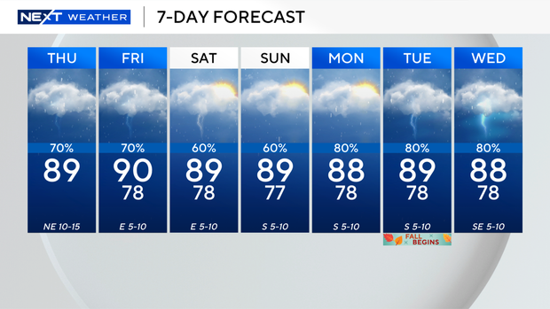
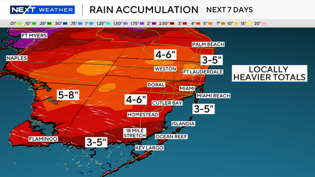
This soggy pattern will stick around through the weekend and into early next week as we will have plenty of moisture and an upper-level area of low pressure moving in.
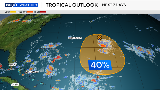
The CBS News Miami NEXT Weather team is tracking an area of low pressure located a few hundred miles east of Bermuda.
The National Hurricane Center said the system has a medium potential of development as it slowly moves westward on Thursday, and then possibly turns southward on Friday over the subtropical Atlantic.