NEXT Weather Alert day in effect as South Florida flood threat continues Wednesday


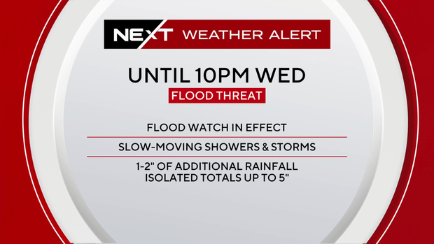
Wednesday is another NEXT Weather Alert Day due to the continued flood risk across parts of South Florida.
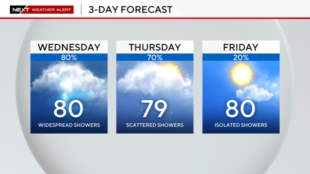
Widespread showers and storms are in the forecast, especially for the afternoon hours.
Some showers could contain heavy downpours, leading to localized flooding possible in the metro areas of Broward and Miami-Dade counties.
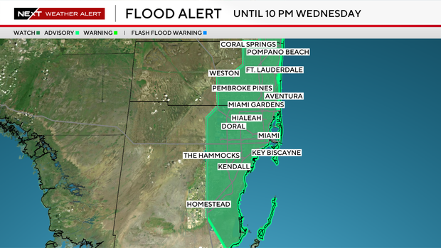
Eastern Broward and Miami-Dade are under a flood watch until 10 p.m., and a level two out of four flood risk on Wednesday.
Coastal showers in the morning will eventually grow scattered to widespread for midday and the early afternoon.
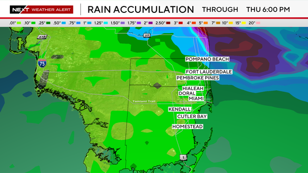
These showers are expected to be slow-moving, and could drop an additional 1-2 inches of rain. Isolated pockets up to 5 inches are possible.
Mild morning temperatures in the lower 70s will lead to a warm afternoon with highs around 80 degrees.
Breezier conditions arrive today and linger through the end of the workweek and weekend.
This brings a high rip current risk at the beach and a small craft advisory for the Atlantic waters.
Looking ahead to the weekend, drier and sunnier weather arrives with only 10-20% isolated shower chances on Saturday and Sunday along with highs around 80 degrees.