South Florida sees another day of king tide flooding ahead of more rounds of rain

King tide saltwater flooding will continue Monday along coastal areas of South Florida.
A coastal flood advisory was in effect until 2 p.m. due to moderate flooding expected during times of high tide.
The king tides are expected to peak on Monday as we did have the full moon over the weekend.
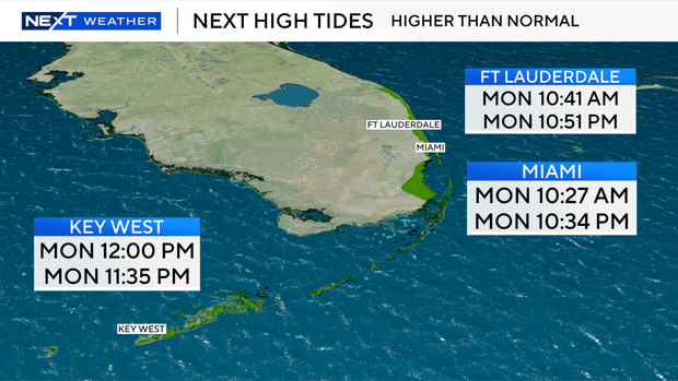
On Monday, the high tide in Fort Lauderdale took place at 10:41 a.m., and the next is at 10:51 p.m.
In Miami, it took place at 10:27 a.m. and the next one takes place at 10:34 p.m.
In Key West, high tide was at noon and is expected again at 11:35 p.m.
In addition to higher-than-normal tides, there has been a dangerous high risk of rip currents along our Atlantic beaches.
CBS News Miami is tracking an active wildfire in western Broward County called the Alpha Sierra Fire burning west of US 27 near Alligator Alley.
That fire has burned 25 acres and is 10% contained.
The winds are out of the northwest and west on Monday morning, so some residents may see or smell some of the smoke associated with the fire.
The winds are then expected to shift out of the south.
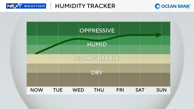
It was a comfortable start to the new workweek as temperatures were in the low to mid-70s.
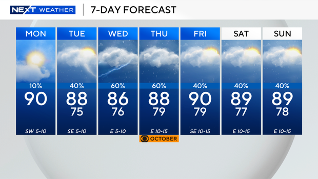
Enjoy the pleasant temperatures and low humidity while you can since we'll heat up to about 90 degrees on Monday afternoon.
Monday will also be our final mainly dry day before the rain returns on Tuesday and the rest of the week.
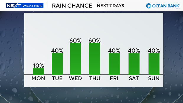
As dry air lifts north, moisture will move in and lead to higher rain chances with the potential for scattered showers and storms every day.
High temperatures will climb into the upper 80s.