California moves out of "extreme drought" following series of drenching storms
A series of huge storms to hit California since late-2022 have coated the state in precipitation, providing encouraging news when it comes to the persisting drought that has been referred to as the worst in the last 1,200 years.
The Atmospheric rivers doused the state from late-December to just this week, bringing tons of snow to mountain ranges — enough to be consider a full winter's worth so far. However, experts predict that much more of the same will be necessary to reverse the effects of the lengthy drought.
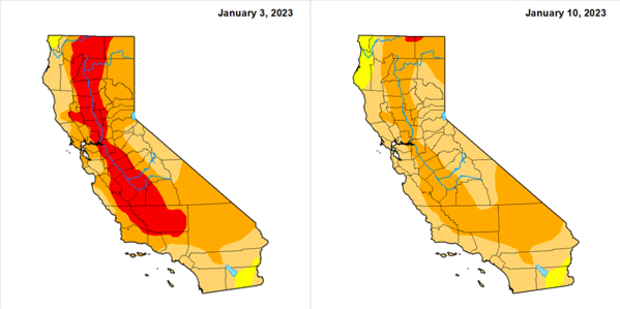
According to the U.S. Drought Monitor's weekly update, which was released on Thursday, the "extreme" drought has been virtually eliminated a week after the worst category — "exceptional" — was washed off the map. Two weeks ago extreme drought covered 35% of California.
The Drought Monitor characterized the improvement as a significant reduction in drought intensity but cautioned that large parts of the state have moisture deficits that have been entrenched for two or three years.
Still, most of the state remains in the "severe" or "moderate" categories of drought, with small areas in the far northwest and far southeast in a status described as "abnormally dry," which is the lowest level.
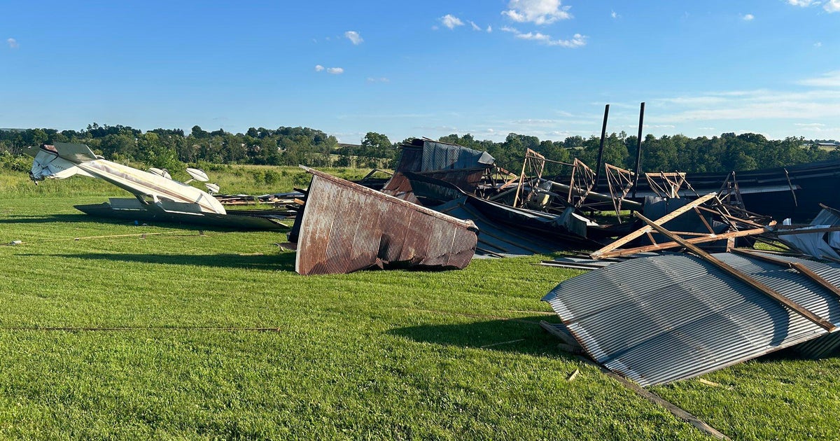
After significant damage to some communities and at least 18 deaths due to the storms, California was busy cleaning up the remnants of those deluges on Thursday, just days before even more precipitation was expected to arrive on Friday and continue through the weekend.
While Northern California was hit hardest by the force of the storms, with many mountain ranges currently at 200% of their normal snowpack at this time, Southern California was also affected by severe flooding and damage as the storms repeatedly doused the area.
In January alone, the Greater Los Angeles region has picked up 5.28" of precipitation, far above the average of 1.39" to this date, with two weeks to go in the first month of the new year.
The snowpack supplies roughly a third of California's water when it melts and runs off into rivers and reservoirs.
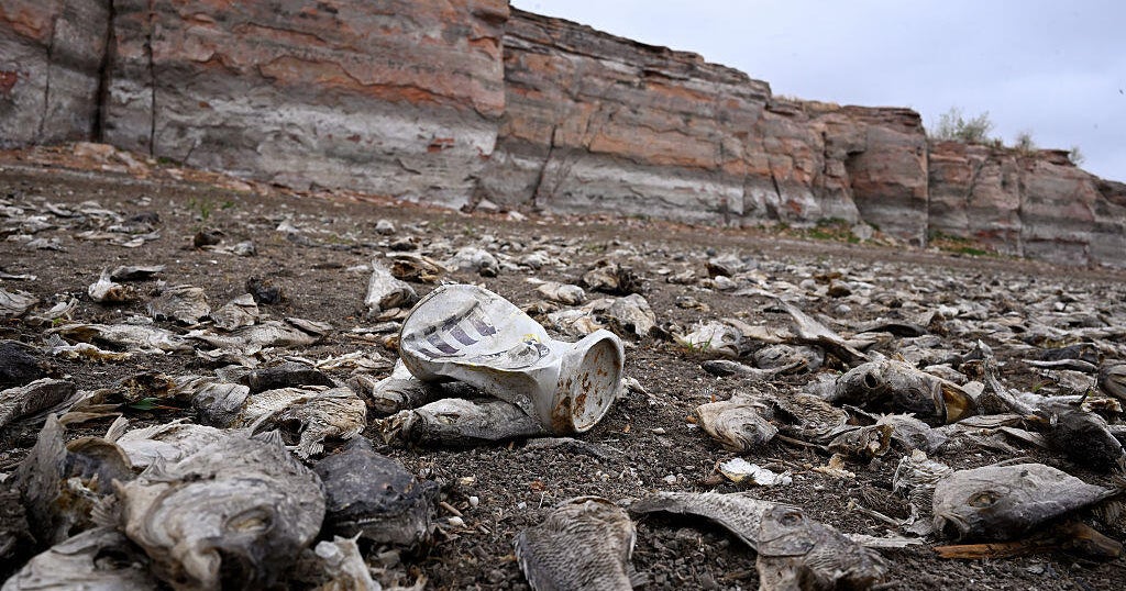
Local reservoirs have seen a noted increase in water levels, but experts say that there is still a large deficit to overcome for the drought to be considered "over."
Statewide, reservoir storage is only 82% of average for this time of year. The largest reservoir, Shasta, is at just 44% of capacity. That's only 70% of average to date. The huge Oroville reservoir is closer to its average but at just 49% of capacity.
"The good news is that they're off historic lows," state climatologist Michael Anderson said of the big reservoirs. "The challenge is that they still have a lot of recovery to make before they would be back to normal operating conditions."
And there's concern that the rains could abruptly stop. The end of 2021 was marked by significant storms, but the start of 2022 saw months of bone-dry weather.
There are some hints of a drier pattern developing around Jan. 20, said Daniel Swain, a climate scientist at the University of California, Los Angeles, during an online briefing this week.