Spring-Like North Texas Weather Saturday & Sunday, Before Bitter Cold Returns Next Week
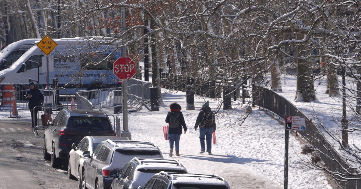
NORTH TEXAS (CBSDFW.COM) — While the northeast will be dealing with a bomb cyclone, including hurricane force winds and nearly 2-feet of snow, North Texas will be enjoying a taste of spring this weekend.
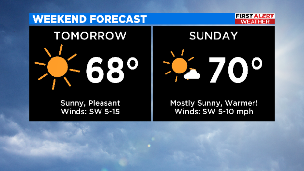
Saturday starts off cold, with temperatures near freezing, but we warm into the upper 60s. Expect full sunshine for the afternoon. I went for it Sunday, put the big 7 and 0 right next to each other... yuppers. Hopefully you can make some outdoor plans this weekend.
Let me back up, I seem to have breezed right by today's forecast in my excitement over our spectacular weekend weather. It's a cold start this morning with temperatures in the 30s. But the sunshine is back. Today will be more seasonal and not quite as warm as the weekend, we top out in the mid 50s. Perfect Trail weather.
Now lets look ahead to next week. I know, I know. One should not rush through the weekend. But as the First Alert Weather Team we want to make sure you are aware of any impactful weather well in advance.
Monday, it's not so bad. Temperatures are still in the mid 60s but clouds roll in and showers accompany them. The heaviest rain will likely be along and south of Interstate-20. I am currently siding with the GFS model on this one.
Tuesday, also not so bad. Temperatures continue to reach the mid 60s with clouds lingering. This is our "in between" day. "In between what?" you ask... or maybe you don't. Hoping it will keep the next arctic front from invading North Texas. Well I checked the models again, and sorry, it still plans on barreling into the Metroplex. So our Tuesday is "in between" leaving the heavy coats at home and having to put on every article of winter clothing you own to go outside.
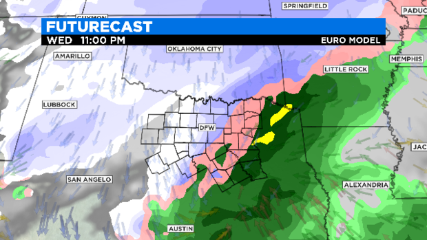
Which brings us to Wednesday, our transition day. Transitioning us into bitter cold through a potential rain/snow mix. Now models still don't agree on: timing of precipitation, precipitation type, or amount of precipitation. They do agree we will likely see precipitation around Wednesday into Thursday. Here I am showing the European model. Green is rain, pink a mix of rain/sleet/snow, and white-blue is for snow. Once again don't take this as a promised forecast. It is just to give an idea of what we are monitoring. The forecast will evolve quite a bit between now and the middle of next week.
We could also see the return of single digit wind chills late week. Again….
Hopefully everyone can get out and enjoy the sunshine this weekend! Rest assured the First Alert Weather Team will stay vigilant with the changes headed our way.