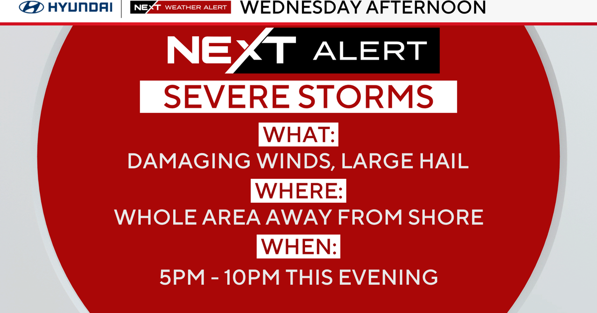
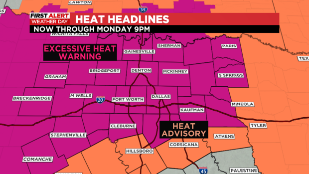
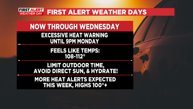
First Alert Weather Days extended through Wednesday due to dangerous heat
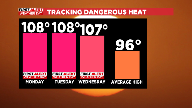
NORTH TEXAS (CBSDFW.COM) — Today was the start of a four-day stretch of First Alert Weather Days. Today, high temperatures reached 106º at DFW Airport.
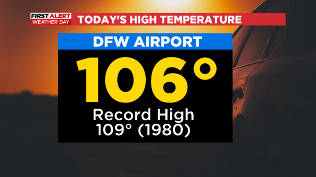
Wow! The last time we were this hot was July 8 when DFW Airport reached 106º.
The dangerous heat won't be letting up for at least the next three days. So, First Alert Weather Days are posted through Wednesday.
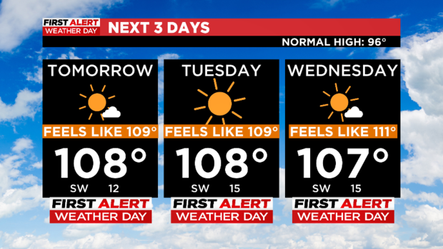
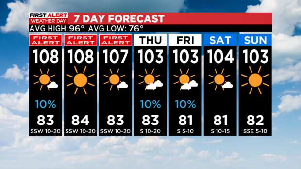
High temperatures will be around 107-108º each day. Feels-like temperatures could rise above 110º in a few communities.
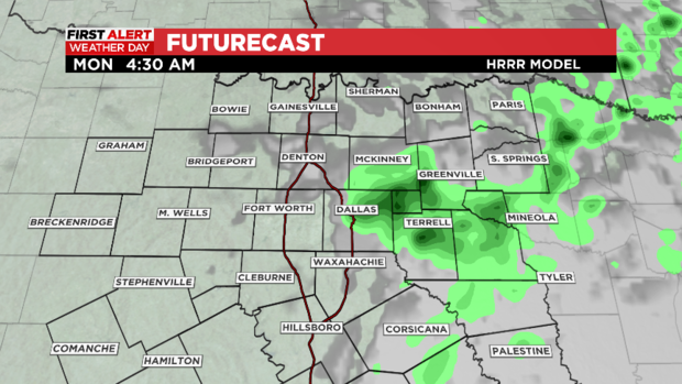
Late tonight into early Monday morning, a couple of showers/isolated storms could move in from the north. We're not expecting much rain out of it.
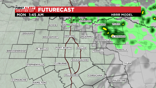
However, a few showers are expected mainly toward the Red River. A couple of showers could push as far south as the Metroplex into early Monday morning. Right now, the rain chance is around 10-20%.
Temperatures won't be quite as hot by Thursday and Friday. Highs will "drop" to around 103 each afternoon. We'll also have about a 10% chance of a shower Thursday and Friday.