First Alert Weather Day tonight into early Wednesday morning
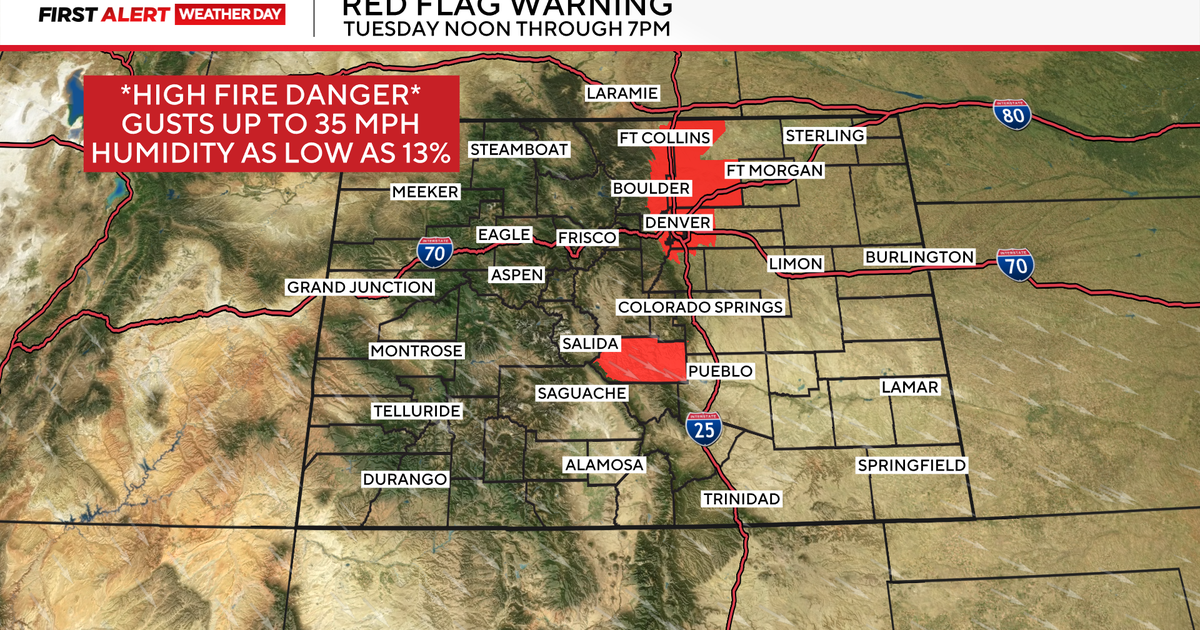
NORTH TEXAS (CBSDFW.COM) - We are watching the elevated fire threat that continues today west of the I-35 Corridor. We will also have strong-severe storms moving quickly from west to east starting around 10pm Tuesday and continuing through daybreak Wednesday.
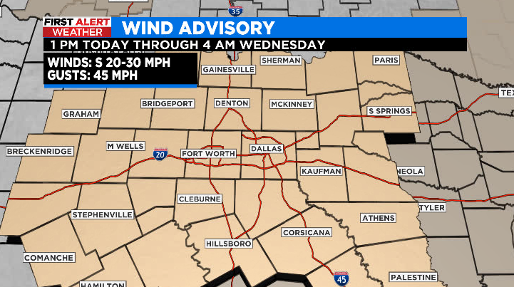
Through this afternoon we will have windy and warm conditions. The elevated fire threat continues, mainly west of I-35, but relative humidity is slightly higher due to south winds so the threat isn't as substantial as it was over the weekend. Wind Advisory goes into place at 1 PM for south winds gusting up to 45 mph (take care of patio furniture, umbrellas, outdoor flags, etc).
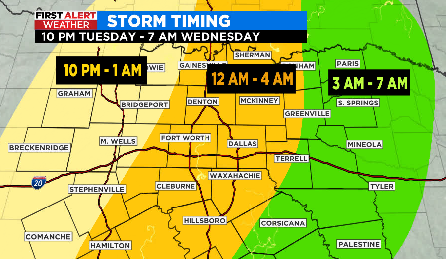
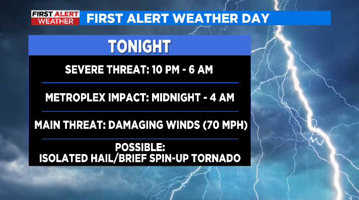
Tonight we wait for storms to develop out west along a dryline/cold front setup. This line will quickly move west to east across North Texas overnight. This is an overnight event – activity should be done for most of us by daybreak Wednesday. Main threat will be damaging wind gusts around 70 mph, but isolated larger hail and even some brief spin-up tornadoes along the leading edge of storms won't be out of the question.
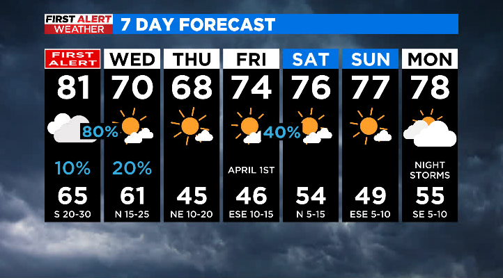
Wednesday most of the storm activity is out of North Texas by daybreak. This system will quickly be racing east and impacting portions of LA/MS/AL during the day. We will still be breezy but our winds will be out of the west/northwest and temps will be slightly cooler. Expect the most notable cooldown by Thursday with highs in the upper 60s.