A Look at Rain Chances This Week in North Texas
GREAT START TO THE WEEK
Temperatures on our Monday have warmed into the mid to upper 80s thanks to sunshine and dry air. It stays warm tomorrow before rain chances arrive on Wednesday cooling us down.
TONIGHT - Fair skies and mild with lows in the mid 60s.
TOMORROW - Mostly sunny and warm. A bit breezy at times. South winds 10 to 20 mph
RAIN CHANCES LATER THIS WEEK
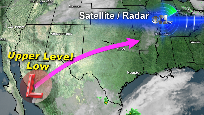
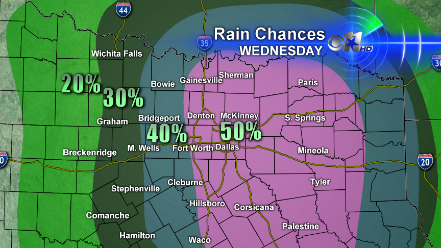
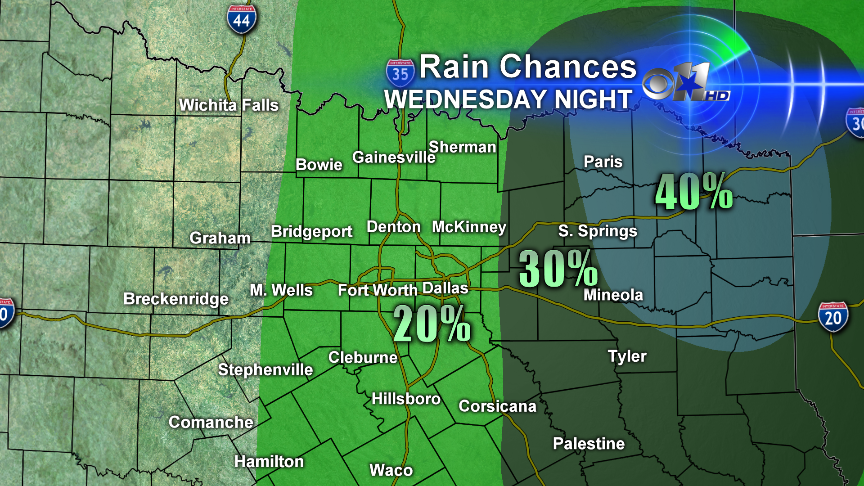
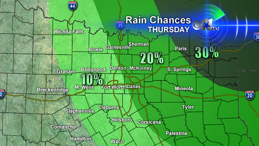
An upper level low that is currently over northern Mexico will move toward North Texas the next few days and arrive overhead on Wednesday. This will lead to shower and thunderstorm chances starting Tuesday night thru Thursday morning. Right now the severe threat looks low, but a few strong storms can not be ruled out. This does not look like everyone will see rain, but instead we will see disorganized showers and thunderstorms bubbling up across the region. Coverage could push as high as 50% at times, so at least the odds are in your favor that you will see some rain at some point starting Tuesday night thru Thursday morning.
UPPER LEVEL LOW'S CURRENT POSITION AND TRACK
RAIN CHANCES
TUESDAY AFTERNOON
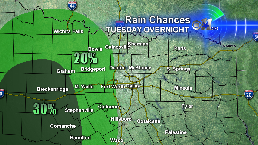
TUESDAY OVERNIGHT
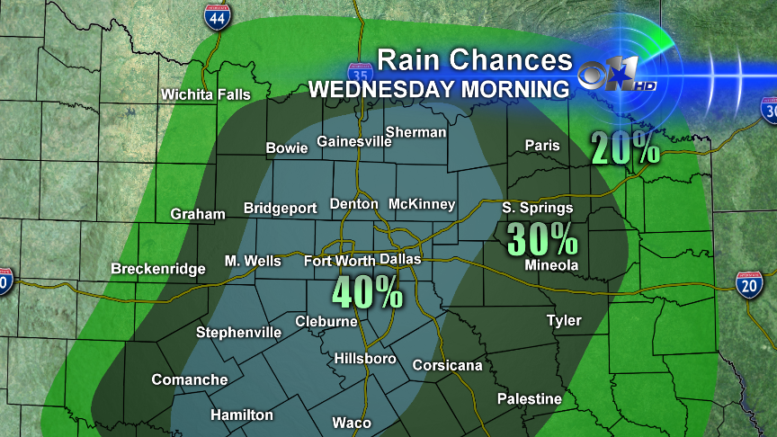
WEDNESDAY MORNING
WEDNESDAY AFTERNOON
WEDNESDAY NIGHT
THURSDAY MAINLY MORNING


