Severe storms moving through Southeast Michigan Sunday

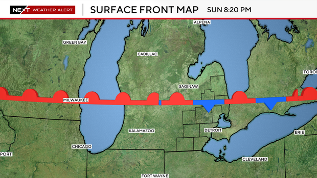
Severe storms are moving through the northern portion of Southeast Michigan on Sunday evening.
According to the National Weather Service, a tornado warning was in effect for northern Sanilac County and Southeastern Huron County until 7:30 p.m.
A severe thunderstorm warning was also in effect for the same counties until 7:30 p.m. The storms were expected to produce hail damage to vehicles and wind damage to roofs, siding and trees, according to the federal weather agency.
The CBS News Detroit NEXT Weather Team issued a NEXT Weather Alert for the afternoon and evening Sunday as a warm front moves through Southeast Michigan.
The Storm Prediction Center (SPC) has adjusted its short-term guidance to reflect an increased risk for severe storms, shifting the primary focus to communities situated along and north of the M-59 corridor.
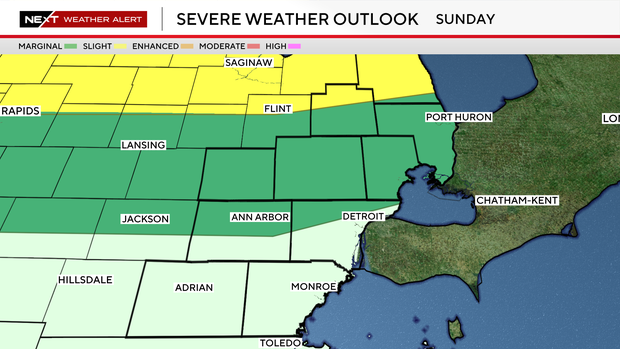
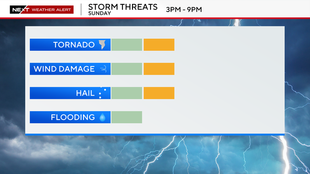
Between 3 p.m. and 9 p.m. Sunday, strong storms will attempt to fire along the warm front as it moves north.
The front will be stationary for a few hours, allowing storms to continue forming in sequence along the boundary.
With the heat of our day, and the setup we see along frontal boundaries like this, severe weather is possible but not certain.
Damaging winds and hail are the primary concerns, but along warm fronts, there is a tendency to create enough "spin" in the atmosphere to allow a tornado to form.
This is the main reason for the increased risk.
If you are along and north of M-59 today, keep a close eye on the radar.
The NEXT Weather Team is monitoring and will provide updates as any strong storms develop.
A reminder, severe weather is also possible Monday and Tuesday this coming week, so be sure to stick with us throughout the next potentially active days.