Severe weather possible again for Southeast Michigan; NWS confirms nine tornadoes since Sunday


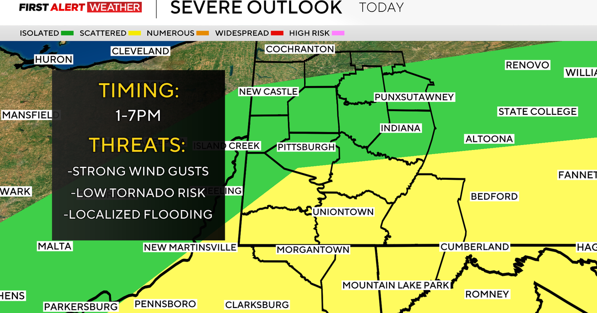
Severe weather season has definitely settled in for this spring, with Michigan having already faced one round of tornadoes on Sunday and a potential for a repeat scenario Wednesday night.
Tornado count from Sunday
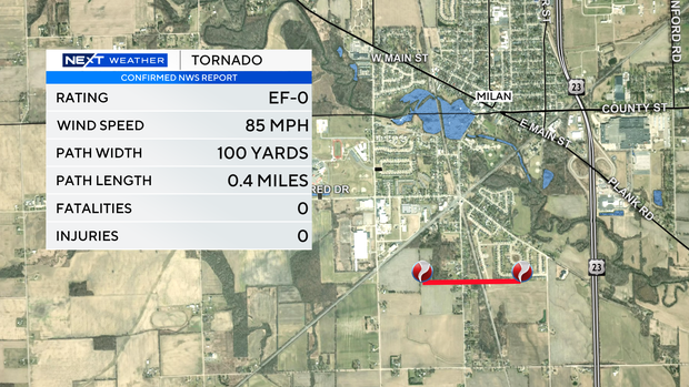
The National Weather Service has confirmed nine tornadoes, mostly in mid-Michigan, amid Sunday's weather. One more report in Branch County is still under investigation. All of them were rated EF-1 or EF-0.
The confirmed list includes a small tornado, rated EF-O, that hit along Wabash Road near Milan in Monroe County
An average of 15 tornadoes hit somewhere in Michigan each year, the NWS reports.
Tornado alert wording
The phrasing to be aware of in tornado-specific announcements issued by the National Weather Service includes:
Tornado watch: Conditions exist that allow a tornado to form. These are often in effect for a few hours.
Tornado warning: A tornado has been sighted or indicated by radar, and the warning is for a specific time and location. The signs to also be alert for include a dark, possibly greenish sky; large hail; a large, dark, low-lying cloud; and a loud roar caused by the spinning winds.
Tornado emergency: This is the highest level of tornado warning. One was issued for the first time in Michigan in May 2024 in response to dangerous weather in the southwest part of the state.
What do to in response to a tornado warning
Michigan's Severe Weather Awareness Week took place March 16-22, with a voluntary tornado drill on March 19. Numerous state and local agencies and media outlets provided safety tips and reminders for the spring and summer season ahead.
For information about emergency preparedness kit suggestions, and recommended places at home or away in response to a tornado warning, go to www.michigan.gov/miready.
The main instruction is to get into the lowest level of a building, away from windows, to wait out a tornado warning.
Heavy rain preparations
The National Weather Service issued a flood watch for several counties in Southeast Michigan for Wednesday evening into Thursday morning.
Ahead of that forecast, some of the area municipalities and utilities issued reminders to residents who have experienced basement backups in the past during heavy rains to be on the lookout Wednesday night into Thursday.
"We do not expect any problems to arise, but this is your friendly reminder to pay attention to the weather and take reasonable precautions to avoid property damage," the City of Monroe posted on its social media accounts earlier this week.
Great Lakes Water Authority, whose services include sewage for parts of Wayne, Oakland and Macomb counties, said the predicted rainfall is within the capacity for the stormwater systems it manages, as earlier rain has moved out of the sytem.
But as a precaution, GLWA suggested those who live in low-lying areas that are prone to flooding during heavy rain to remove any items of value that may be currently in basements. "It is also helpful if residents do not run their washing machines and dishwashers during heavy rain events," GLWA said.
DTE Energy prepares for storm response
Ahead of Wednesday's expected storms, DTE Energy is providing the following safety tips for residents.
Stay informed
The CBS Detroit NEXT Weather Team will continue to monitor these upcoming storms. For the latest forecast, watch on air, online, or on the stream on CBS Detroit and PlutoTV.