More snow headed to Southeast Michigan on Wednesday, impacting morning commute

Wednesday is a NEXT Weather Alert Day in Southeast Michigan, as falling snow will likely impact the morning commute.
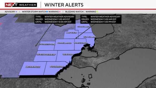
The National Weather Service has issued a winter weather advisory for 3 a.m. to 1 p.m. Wednesday for all of Southeast Michigan.
A low-pressure system will cross from lower Lake Michigan to Lake Huron on Wednesday, bringing widespread snow overnight and into the early afternoon.
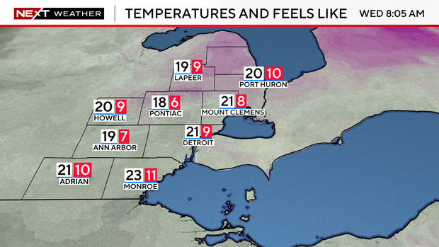
Expect impacts to the Wednesday morning commute with falling snow, gusty winds, and windchills between 7 and 10 degrees Fahrenheit.
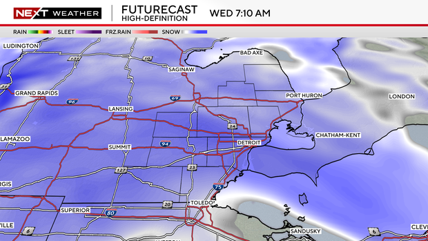
Temperatures will rise overnight as warm air ahead of the system moves in. Snow will start after 1 a.m., with the most intense snowfall predicted to fall between 5 a.m. and 10 a.m.
Expect between 1 and 3 inches of accumulation by the time the system clears out, with 2 to 3 inches possible in the I-94 to I-69 corridor and locally higher amounts possible.
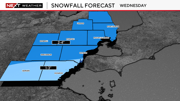
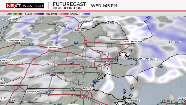
A cold front moving through in the late afternoon will push the system northeast.
Some lingering light snow may go on into the evening, but little to no accumulation is expected.
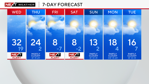
Friday and Saturday are also NEXT Weather Alert Days due to the extreme cold moving in after this system clears out.