Mild temperatures and rain in store for Southeast Michigan on Wednesday

Metro Detroit is in for a midweek warm-up, but you'll need the umbrella and perhaps a little extra patience on the roads before we get there.
Rain is set to move into the region Tuesday night, bringing wet conditions that will persist through Wednesday morning.
Rainfall amounts should be around half an inch overall with some soaking rain, and even a few rumbles of thunder are possible as temperatures warm with the front.
In addition to the rain, patchy dense fog is possible overnight and into the early morning hours, likely reducing visibility for the morning commute before the winds pick up.
We may see more advisories for the fog, like what we experienced this morning.
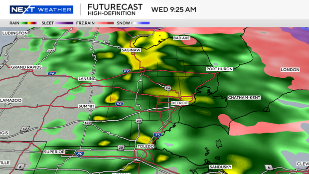
The wet weather won't last all day, however. The rain is expected to wrap up by late morning, making way for significant clearing.
As the clouds break, sunshine will take over for the midday and afternoon hours.
That sunshine will help boost temperatures significantly.
Highs are forecast to reach near 60 degrees, well above average for this time of year. Along M-59 and toward the lake, temperatures in the 50s are more likely, while temperatures much closer to the lake should be in the 40s.
It will also be a breezy day, with winds kicking up as the fog dissipates and the warm air settles in.
Forecast Breakdown:
Tonight: Rain begins, patchy dense fog developing.
Wednesday Morning: Rain continues, fog lifts as breezes increase.
Wednesday Afternoon: Skies clear, becoming sunny and breezy with highs near 60.