Dangerous cold air headed to Southeast Michigan, cold weather advisory for Friday

Dangerous cold air is likely to wrap up this week and kick off the weekend in Southeast Michigan.
Cold air will begin immediately on Thursday as temperatures fall from the moment we hit midnight, through the rest of the day. By the evening on Thursday, wind chills will be back near 0 degrees Fahrenheit or just below.
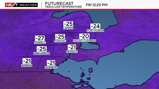
Friday is an all-day event. Highs on Friday will be in the single digits with winds gusting throughout the day.
Wind chills will be possible colder than -20 degrees Fahrenheit, with some models suggesting colder than minus 25 degrees Fahrenheit by Saturday morning.
Friday and Saturday will be cold enough that frostbite is possible on uncovered skin in 30 minutes.
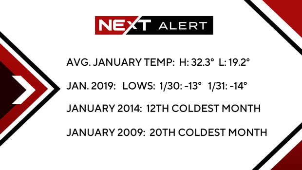
This cold is also the coldest air since January 2019.
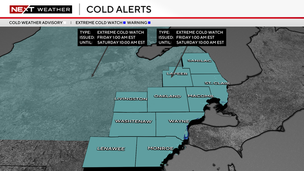
A cold weather advisory is in effect for all of Southeast Michigan from 1 a.m. Friday through 10 a.m. Saturday, due to the dangerous wind chills expected.
Stay with the CBS News Detroit NEXT Weather team for updates as we enter this latest arctic blast.